
I have never walked the Bondi to Coogee walk in one go. I walked it twice, from opposite ends, on two very different days. Both times I stopped in the same windy clifftop park above Clovelly without planning to.
The first time, I set off from Coogee on a cloudy February afternoon with the wind whipping the sea white. The second time, I started at Bondi in the late evening, watched the sun drop behind the suburbs somewhere near Tamarama, and reached Waverley Cemetery with the first stars coming out over the headstones. Between those two walks I covered the whole coastline from Bondi to Coogee, in grey light and gold, from beach volleyball to near darkness.
This guide is everything I wish I had known before the first walk: the route stop by stop, which direction to choose, how long it really takes, where to stop if your legs give up, when to go and how to get back. Every photo in it is mine.
In short: the Bondi to Coogee walk is a 6 km (3.7 mile) one-way coastal path through Sydney’s eastern suburbs. It takes 2 to 3 hours with stops, passes five beaches and two bays, and is free, paved and well served by buses at both ends. If you’ve seen it called the Bondi Coastal Walk, it’s the same path: locals often use that name for the whole route, or just the Bondi to Bronte section.
This post contains affiliate links. If you book through them, I may earn a small commission at no extra cost to you.
Distance
6 km one way
About 3.7 miles · guides quote 5.5 to 6.5 km
Getting there
Bus 333 to Bondi · 373/374 from Coogee
Tap on with Opal or contactless
Time
2 to 3 hours with stops
About 1.5 hours non-stop
Difficulty
Grade 2, paved
Lots of stairs · steepest at Gordons Bay
Start / finish
Bondi Icebergs / Coogee Beach
Halfway: Burrows Park, Clovelly
Toilets and water
At every beach
Cost
Free to walk
Bondi Icebergs pool ~$10 · standard Opal bus fares
Best time
Early morning, or late afternoon into dusk
Avoid 10am to 3pm in summer
Bondi to Coogee Coastal Walk Map
The full 6 km route from Bondi Icebergs to Coogee Beach, past Tamarama, Bronte, Waverley Cemetery, Clovelly and Gordons Bay.
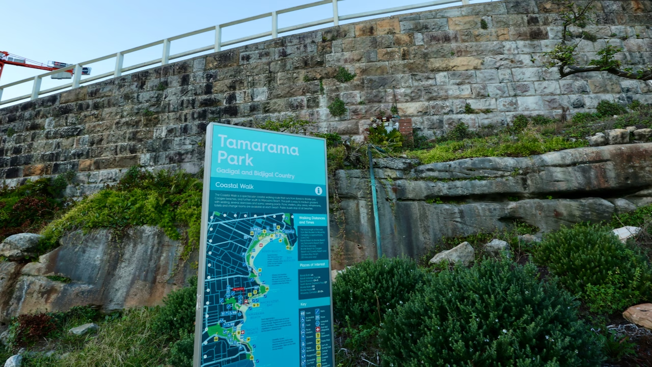
Officially it’s the Bondi to Coogee Coastal Walk, and it’s simple to follow. You keep the ocean on one side and you won’t go far wrong. There are council map boards at the beaches (I photographed one at Tamarama), and the path is signposted for most of its length. The only places I lost it were around Gordons Bay and between Clovelly and Coogee, where the route briefly follows residential streets. I’ll point those out below.
Why It’s Sydney’s Best Coastal Walk
Sydney has plenty of beautiful walks. I loved the short South Head Heritage Trail out to Hornby Lighthouse at Watsons Bay, and the harbour foreshore around the Opera House. But if someone asked me for the single most beautiful walk in Sydney, this is the one I’d send them on.
It packs an absurd amount into 6 km.
In under two hours of walking you pass
It’s also a real part of the city. Locals use it for morning runs and dog walks, and the beaches are run by the suburbs they belong to, each with its own surf club, toilets and café.
The names along the way are far older than the suburbs. Bondi is thought to come from boondi, an Aboriginal word usually translated as “water tumbling over rocks”, which is exactly what you watch for 6 km. Coogee is often said to mean “bad smell”, from the seaweed that rotted on the beach. The whole walk follows coastline traditionally occupied by the Bidjigal, Birrabirragal and Gadigal peoples.
If you’re wondering whether it lives up to the hype: it does, even done in halves, and even in grey weather. Neither of my walks covered the whole route, and both showed me some of the most beautiful coastline I saw in Sydney.
Bondi to Coogee Walk Distance and Time
The official figure from Destination NSW is 6 km one way, taking 2 to 3 hours. Walking non-stop at a steady pace, most people take about 90 minutes.
You’ll also see the walk described as passing “six beaches”. The official count is five beaches (Bondi, Tamarama, Bronte, Clovelly and Coogee) plus two bays. Gordons Bay, with its small strip of sand, is the one most people count as the sixth beach, and Mackenzies Bay only becomes a beach in certain years.
If you read a few guides, you’ll see the distance quoted as anything from 5.5 km to 6.5 km, and the Bondi to Bronte section as 2 km, 2.5 km or 3 km. Nobody is wrong. It depends on where you start counting. Measured from the Icebergs pool to the first headland at Coogee, the walk is shorter. Measured from the middle of Bondi Beach to the middle of Coogee Beach, it’s longer. The council map board at Tamarama gives Bondi Beach to Bronte Beach as about 3 km (around 45 minutes) and Bronte to Coogee via Clovelly and Gordons Bay as about 3.6 km (around 50 minutes).
How long does the Bondi to Coogee walk take?
The time on your watch depends far more on your stops than your pace. You’ll stop for photos at almost every headland. Add time for a swim, a coffee at Bronte, or simply sitting and watching the surfers, and 3 hours disappears easily.
How hard is it?
The path is paved the whole way and Destination NSW rates it Grade 2, suitable for most ages and fitness levels. The catch is the stairs. Every beach sits in a dip between two headlands, so you go down to the sand and back up again five times. Walkers who have tracked the route by GPS (Earth Trekkers, for one) put the total climb at around 190 metres. I wouldn’t call any of it hard, but on a hot day it’s tiring, and the climbs out of Gordons Bay are the steepest of the walk.
Here’s how each stretch felt to me:
| Section | Surface | Stairs and climbs | How it felt |
|---|---|---|---|
| Bondi to Tamarama | Paved clifftop path | A short climb from Notts Avenue, steps around Marks Park | Easy, with the best views of the walk |
| Tamarama to Bronte | Path, then roadside footpath on Bronte Marine Drive | Up and over the headland | Moderate |
| Bronte to Burrows Park | Steps, then the cemetery boardwalk | A climb out of Bronte, then flat | The easiest stretch |
| Clovelly to Coogee | Path, steps and short residential streets | Steep stairs at Gordons Bay, a climb over the Coogee headland | The hardest part |
Don’t have 3 hours?
- About an hour: Bondi to Bronte (about 3 km), the classic short version
- About an hour: Bronte to Coogee (about 3.6 km), the quieter, wilder half
- 2 to 3 hours: the full walk, Bondi to Coogee (6 km)
- 4 to 5 hours: there and back (about 12 km)
Buses stop at every beach, so you can finish wherever your legs give up. Details in the shorter versions section below.
Which Direction Is Best: Bondi to Coogee or Coogee to Bondi?
This is the question I see asked most, and locals answering it online come down on both sides. Having walked from both ends, my answer is: finish where you want to spend the rest of your day.
Bondi to Coogee
- Start at the famous end while you’re fresh
- The classic look back over Bondi, ten minutes in
- Midday sun mostly behind you as you walk south
- A calmer, shadier finish at Coogee
- Buses out of Coogee are less of a scrum on hot weekends
Coogee to Bondi
- The steepest climbs done early
- Sunrise over the ocean from the Coogee cliffs
- Bondi Beach appears ahead of you as the reward
- More food, atmosphere and city buses at the finish
My pick: start at Bondi. Flip it if you want to spend the afternoon on Bondi Beach or catch a sunrise.
The Bondi to Coogee Walk, Stop by Stop
I’ll describe the walk from Bondi to Coogee, the way most people search for it. If you’re walking the other way, read it from the bottom up, or jump to the Coogee to Bondi section below.
Bondi Beach
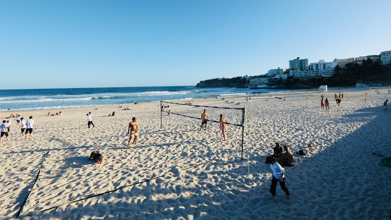
Bondi is where most people start, so arrive early enough to sit for a while first. Every time I’ve been, I’ve ended up doing the same thing: finding a spot on the steps in front of the Bondi Pavilion and watching the beach. Volleyball games run along the southern end, surfers carry boards past toddlers digging holes, and the lifeguard towers keep watch over all of it.
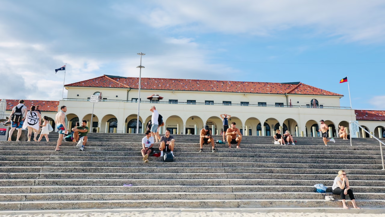
The Pavilion itself, built in 1929 in a mix of Georgian Revival and Mediterranean styles and reopened in 2022 after a restoration, is part of Bondi’s heritage-listed beach landscape. It has public toilets, showers and change rooms, plus a gallery and theatre. I walked through it on one visit and caught an exhibition in progress. It’s a good place for a toilet stop before you set off.
Bondi is very easy to reach. It’s about 7 km from the city centre, and bus 333 runs from Circular Quay to Bondi Beach via Bondi Junction.
If you’ve ever wanted to try surfing, Bondi is the obvious place to learn, and a lesson before the walk makes a good morning.
Bondi Icebergs
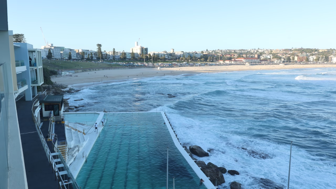
The walk officially starts on Notts Avenue at the south end of the beach, right beside the Bondi Icebergs pool. This was my favourite sight of the whole walk. The 50-metre saltwater pool sits right on the edge of the ocean, and when the swell is up, waves break straight over the outer wall into the lanes while people carry on swimming. On my walk, a swimmer dived in at the exact moment a wave hit the wall.
The Icebergs club was founded in 1929 by local lifesavers who wanted to keep fit through winter, and it describes itself as the only licensed winter swimming club in the world. It’s still serious about the swimming: the original rule, which still stands, requires members to race on three Sundays out of four for five winters before they earn lifetime swimming membership. Women were admitted only in 1995. The winter season traditionally opens with blocks of ice tipped into the pool before the first swim.
You can swim here yourself. Entry is around $10 for adults and includes the sauna, which is how locals thaw out after a winter swim. The pool usually closes on Thursdays for cleaning (in summer it sometimes stays open when the tides allow), so check the club’s pool conditions page before you plan a swim.
Swimming at Bondi? Don’t swim at the south end near Icebergs. A strong, near-permanent rip known as the Backpackers’ Express runs out against the southern headland. Walk north to the red and yellow flags in front of the Pavilion or at the northern end instead.
The look back at Bondi
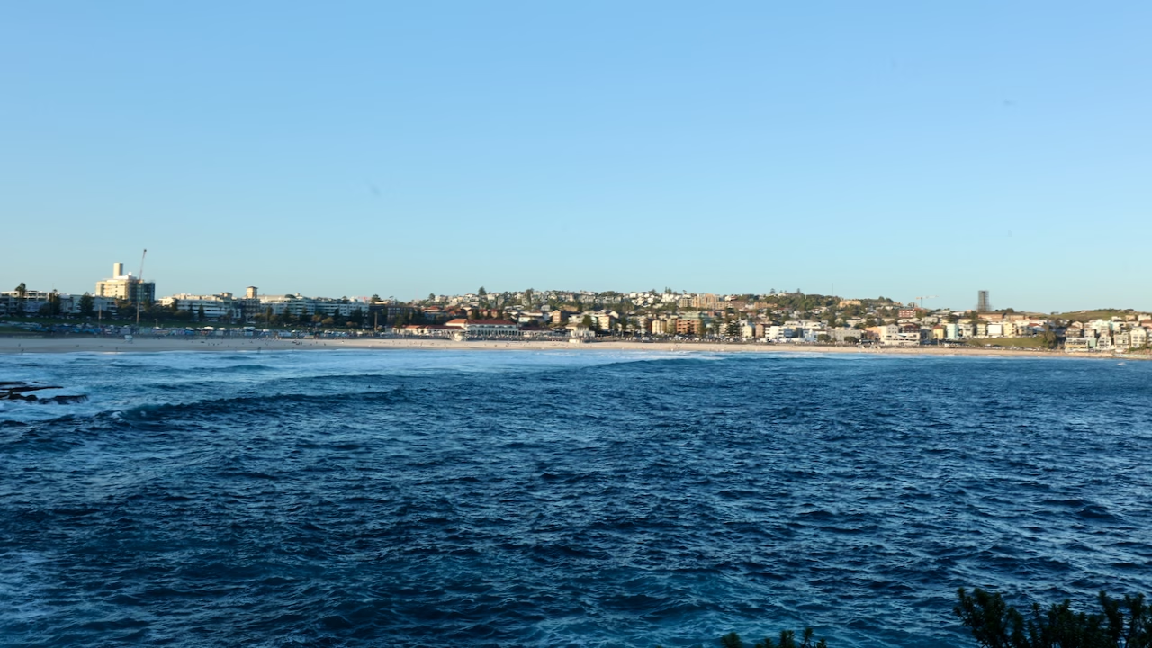
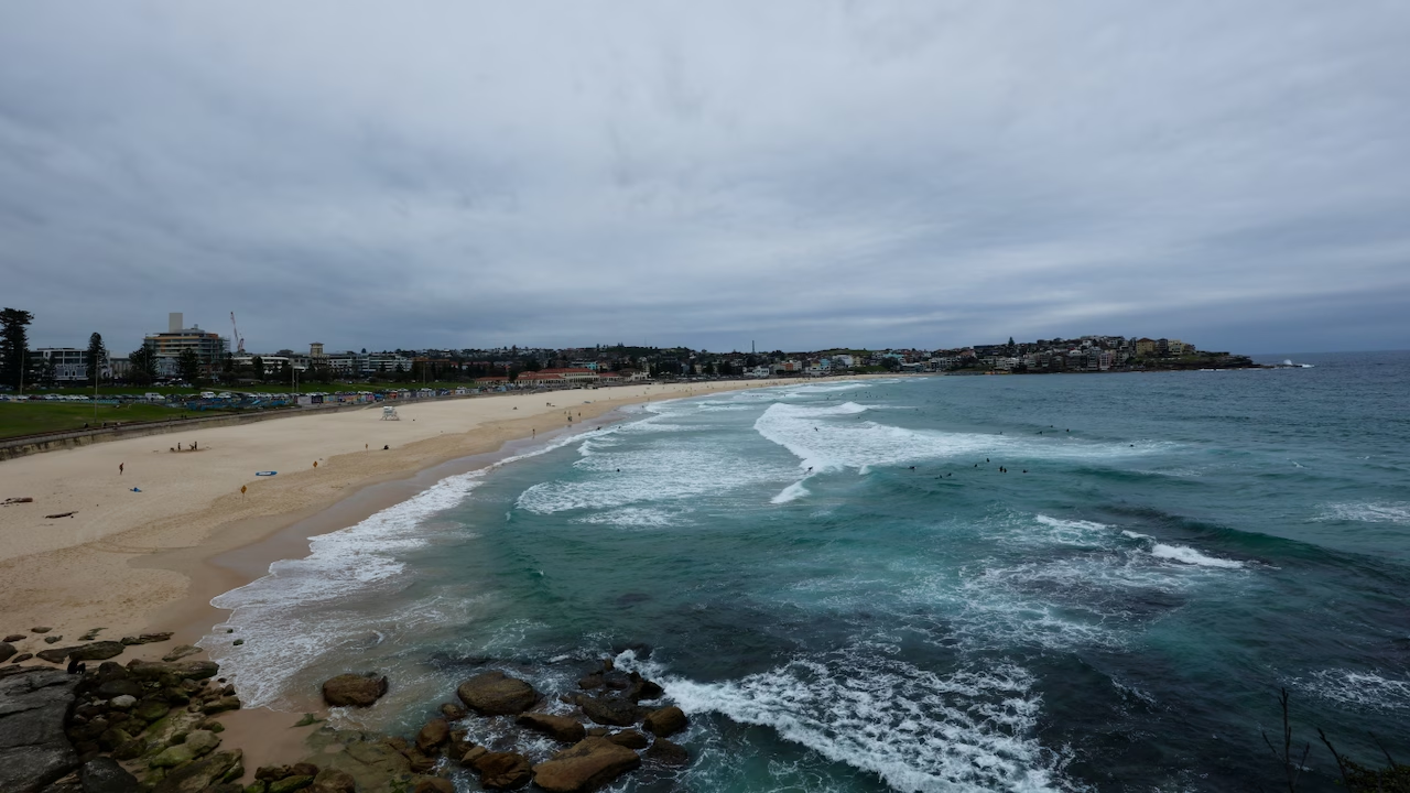
About ten minutes after leaving the Icebergs, the path climbs onto the cliffs. Stop here and turn around. This is the moment I realised how big Bondi Beach really is: the whole golden curve of sand, the red roofs of the Pavilion in the middle, and the houses stacked up on the North Bondi headland at the far end. Most people are too busy looking ahead to notice it.
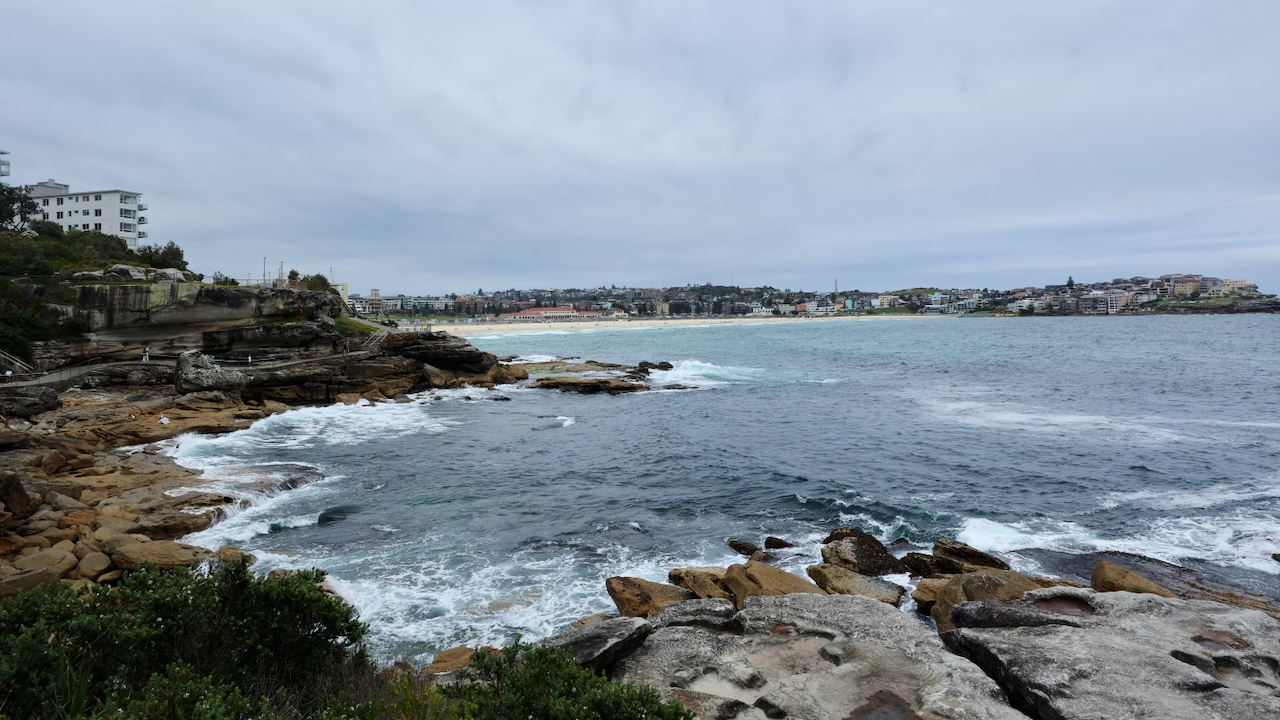
This is also where the stairs begin. The path drops under overhanging sandstone ledges and climbs back up again, and the rock along here rewards a close look. This is Hawkesbury sandstone, the rock Sydney is built on, laid down more than 200 million years ago, and wind and salt have carved it into layered bands and honeycomb hollows.
Marks Park and Mackenzies Point
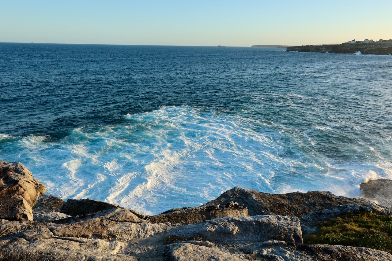
The first big headland is Marks Park, a grassy clifftop with a lookout at Mackenzies Point. The views from here are huge: back north past Ben Buckler towards the harbour entrance, and down onto ledges where the swell explodes into white foam below you.
Look out for the Aboriginal rock engravings on the ocean side of the path. Waverley Council describes the main carving as a six-metre-long shark with a fish inside it and another alongside. The engravings are sacred to the local Aboriginal community, so look from the path and never walk on or touch them.
From May to November, this is also one of the best points on the walk for whale spotting. Humpbacks start passing Sydney from mid-May, and the peak of the northern migration is late June to early July.
This stretch, from Bondi to Tamarama, is where Sculpture by the Sea takes over every spring. More on that below.
Mackenzies Bay: Sydney’s disappearing beach
Just before Tamarama, look down into the small rocky inlet below Mackenzies Point. Most of the time it’s exactly that: rocks, tidal pools and swell surging in. But every so often, the right run of smaller swells dumps enough sand here to turn Mackenzies Bay into Mackenzies Beach for a few weeks or months. Locals like to say it happens every seven years, though Waverley Council’s local history records a dramatic return in 2007 and it has reappeared several times since. It’s unpatrolled and the water is full of rocks, so admire it rather than swim.
The name comes from the Mackenzie family, who ran a dairy farm on these clifftops from the 1860s until the 1920s. The cows are long gone, but Mackenzies Point still carries their name.
Tamarama
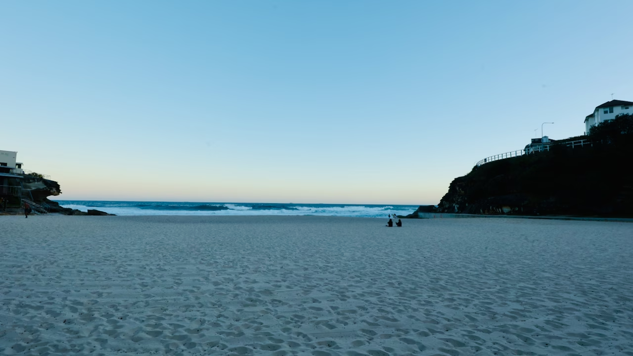
Tamarama is tiny, only about 80 metres of sand squeezed into a narrow gully between two headlands. It has a surprisingly noisy past: from 1887 to 1891 the gully and headland held the Royal Aquarium and Pleasure Grounds, and the beach was known as Aquarium Beach. In the early 1900s the site became Wonderland City, an outdoor amusement park often described as a forerunner of Luna Park. By the time I got there on my evening walk, it was nearly empty: a couple sitting on the sand, two surfers debating one last wave, and a pale pink band spreading along the horizon over the sea.
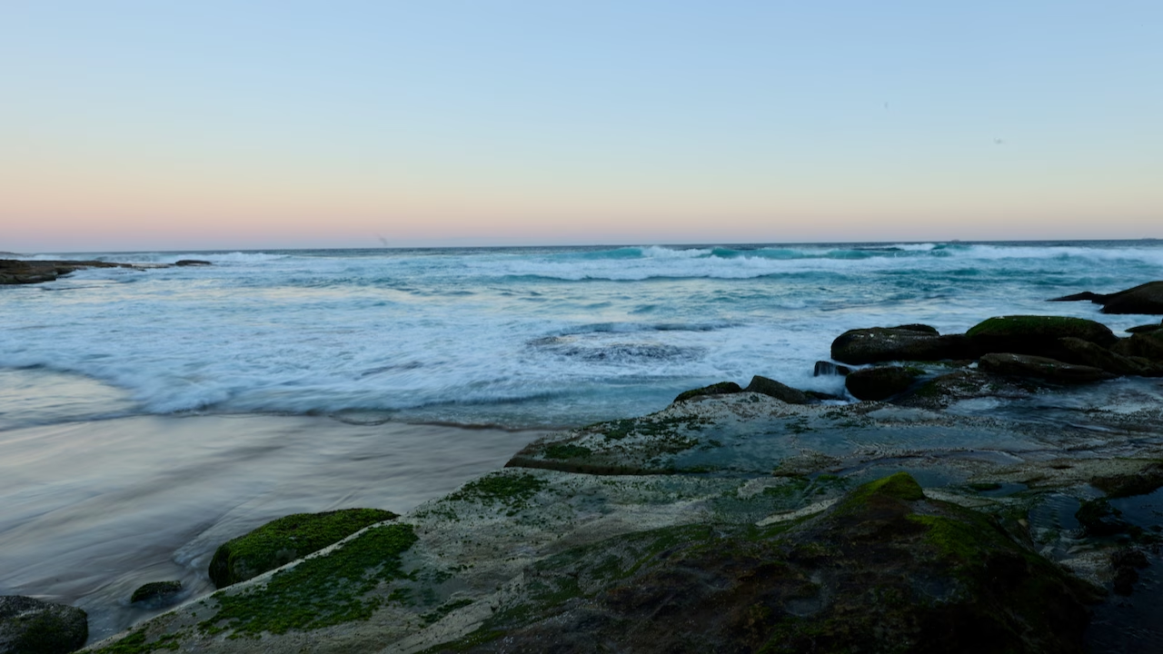
Don’t let the size fool you. Tamarama has the highest rescue rate per swimmer of any beach south of Sydney Harbour, according to Surf Life Saving’s Beachsafe data. If you swim here, stay between the flags and close to shore. There’s a beach café and toilets at the back of the beach, and a council map board where the path leaves the sand.
Tamarama to Bronte
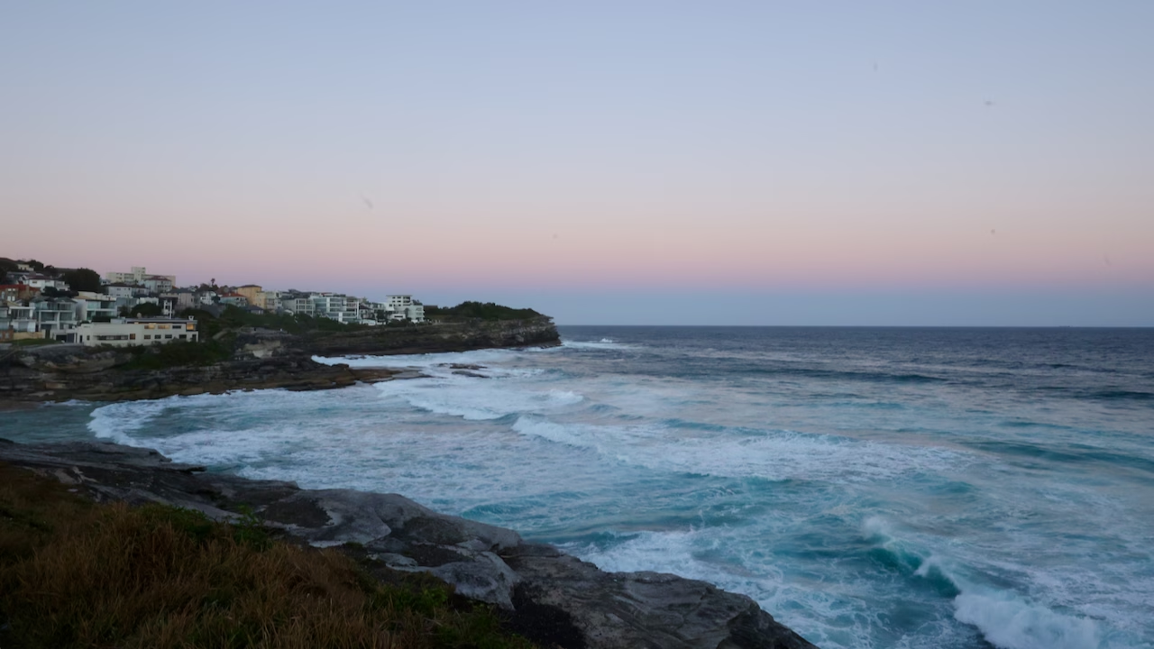
From Tamarama, the path climbs over the next headland. Look back from the top: Tamarama sits in its cove below you with the surf rolling in. On my walk, this was where the sky turned pink and lilac and the houses on the headland started switching on their lights.
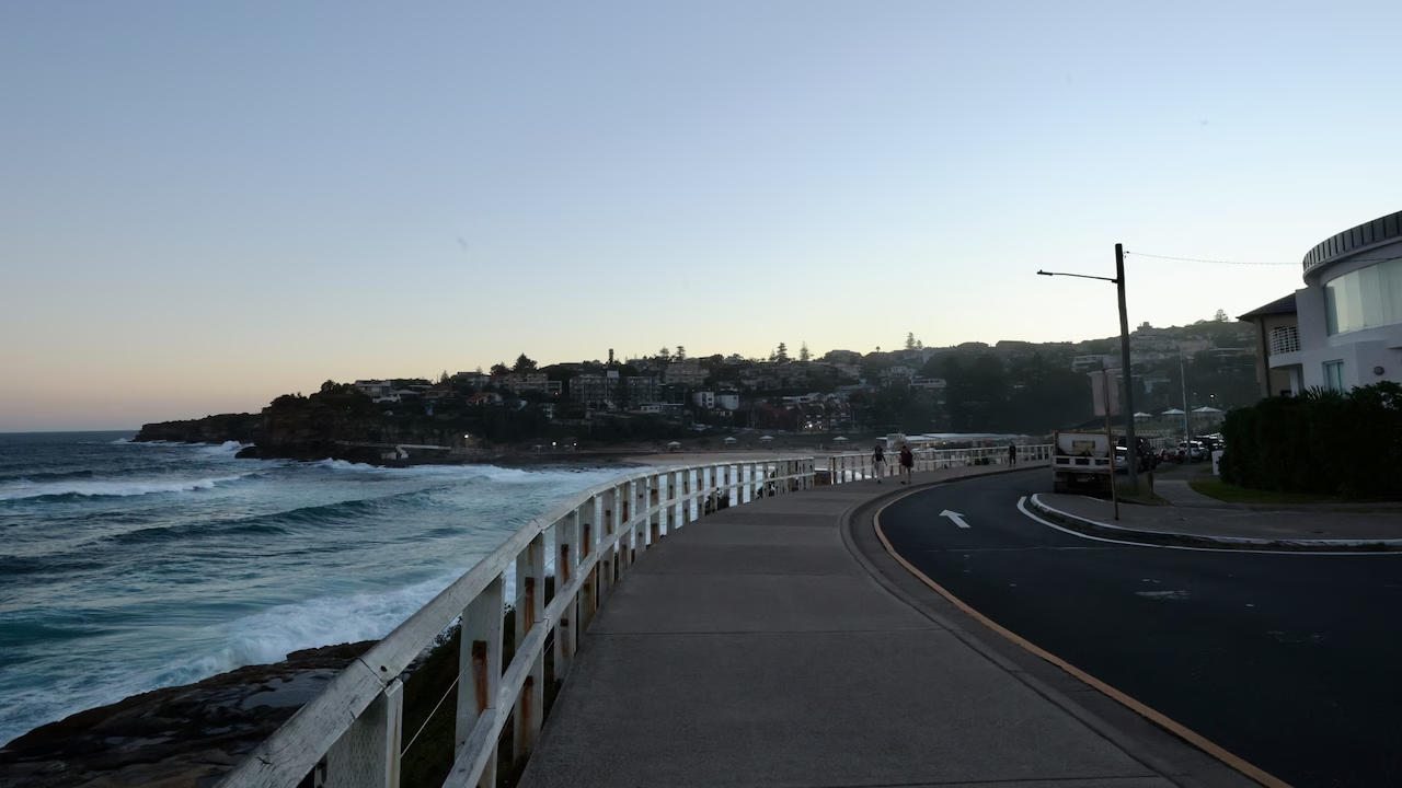
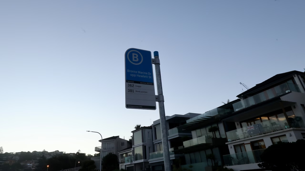
The path then follows the fenced footpath along Bronte Marine Drive into Bronte. If you’re starting to flag, there’s a bus stop here, Bronte Marine Dr opp Hewlett St. The sign I photographed showed route 362 towards Coogee and 381 to Bondi Junction.
Bronte Beach and Bronte Baths
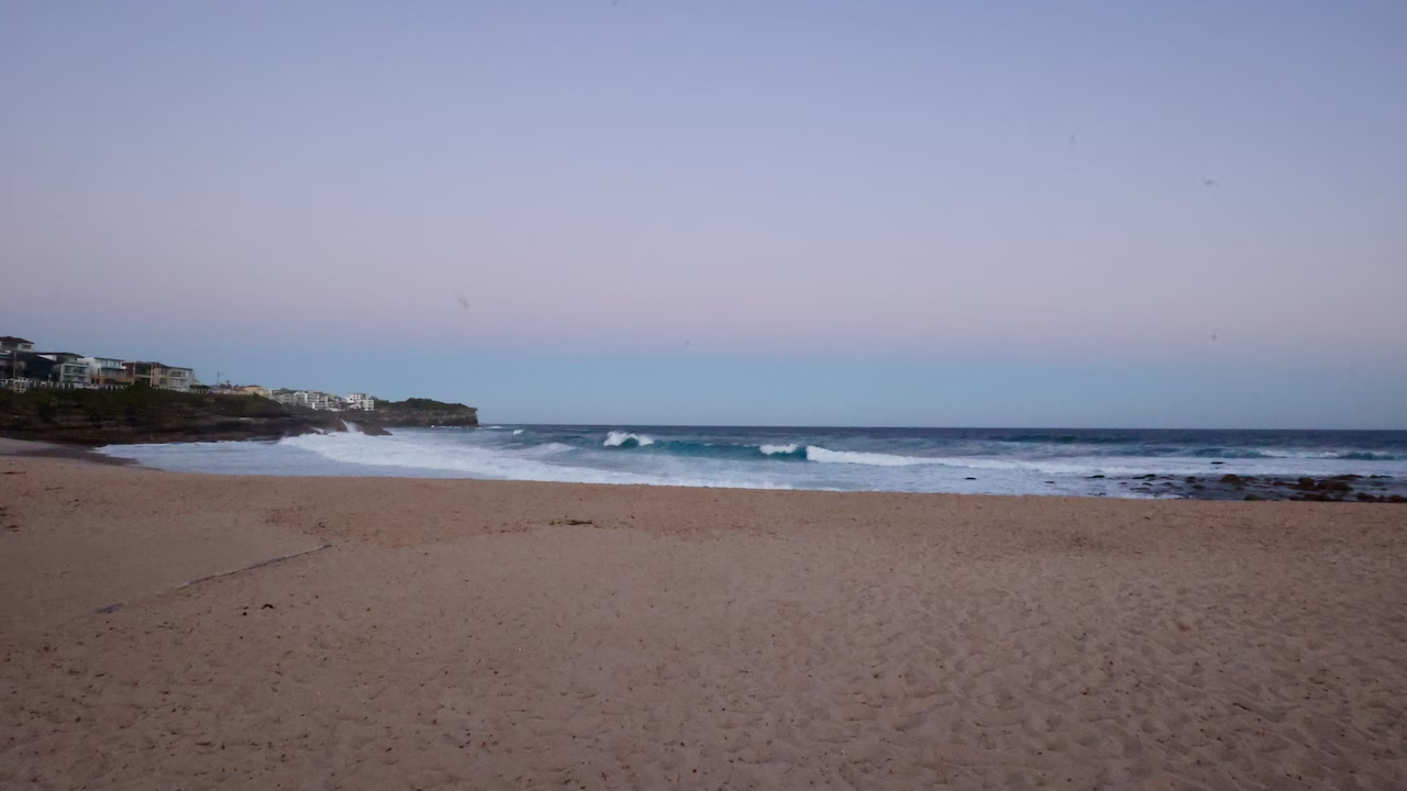
Bronte takes its name from Admiral Lord Nelson, who held the title Duke of Bronte. Today it’s a family beach with a big park behind it, free barbecues and a strip of cafés. Many walkers stop here, either for lunch or for good. Bronte also has a friendly rivalry with Bondi: Bronte’s lifesavers were patrolling here from 1903, while Bondi’s club, founded in 1907, also claims to be the world’s first surf life saving club. The Bondi to Bronte section is the most popular part of the walk on its own (more on that below).
At the southern end of the beach are two places to swim without facing the surf: Bronte Baths, an ocean pool cut into the rocks, and the Bogey Hole, a sheltered natural rock pool. The baths date from 1887, making them one of the oldest ocean pools in Sydney, and they’re free to use. If you skipped the paid swim at Icebergs, this is the place to make up for it. Local historians believe the Australian crawl swimming stroke was first seen here, at the turn of the twentieth century. The open beach has its own rip at the southern headland, nicknamed the Bronte Express, so use the flags if you swim in the surf.
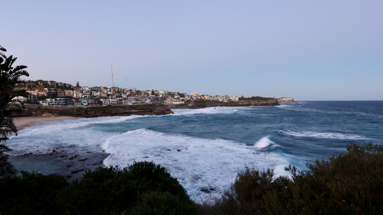
I passed Bronte Baths in the dark on my evening walk, so I can’t show it to you. If you have time, take the short detour to the pool and the lookout beyond it, which the main path skips.
Climbing out of Bronte past Calga Reserve, look back for one of the best “how far you’ve come” views of the walk: Bronte below, then Tamarama, Mackenzies Point and the North Bondi headland lined up into the distance.
Waverley Cemetery and the clifftop boardwalk
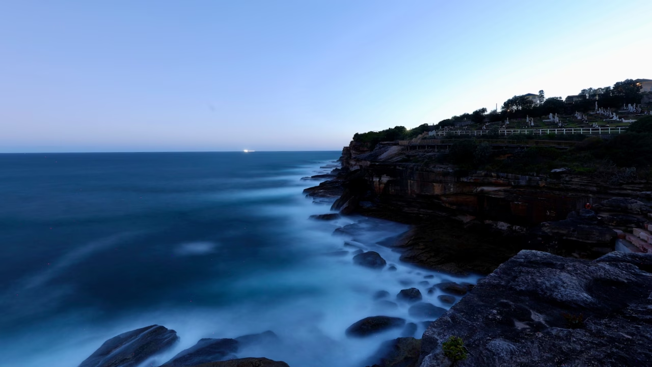
This was the strangest and most memorable part of the walk for me. Waverley Cemetery sits right on the cliff edge, rows of white marble headstones looking out over the Pacific.
It opened on 1 August 1877, is on the NSW State Heritage Register and is still a working cemetery. It’s the resting place of some well-known Australians, including the poets Henry Lawson and Dorothea Mackellar, the test cricketer Victor Trumper, and J. F. Archibald, founder of The Bulletin magazine, whose bequest created Australia’s Archibald Prize for portraiture.
The coastal path runs along the cemetery’s ocean side on the Sesquicentenary Boardwalk, a 515-metre timber boardwalk opened in 2009 for Waverley Council’s 150th anniversary. It has five viewing platforms and the surf breaks around 30 metres below. Storms in June 2016 badly damaged the walk here, and it reopened in 2018 after repairs.
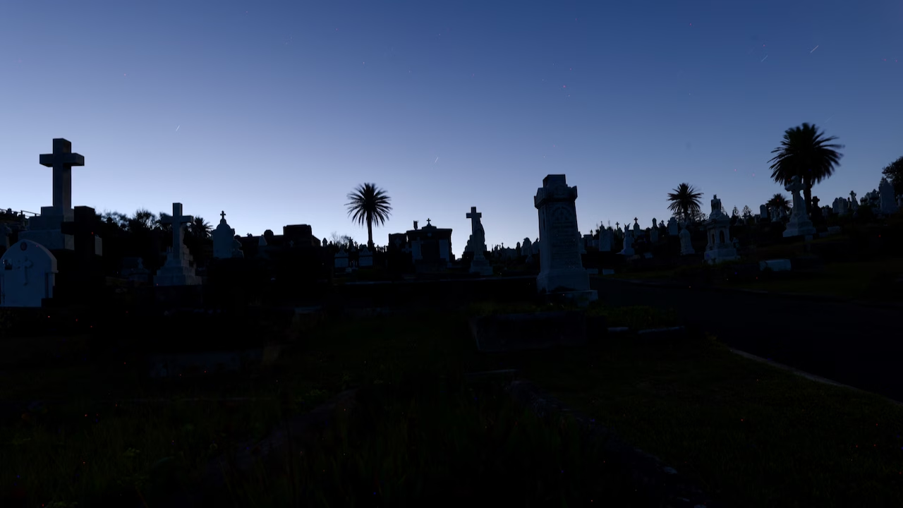
I reached the cemetery as night fell. From the boardwalk I could see the city lights in one direction and waves crashing into the cliff in the other. Then I went in among the graves. With the headstones and palm trees silhouetted against the last blue of the sky, it was spooky. The cemetery is open to pedestrians at all hours, so you can wander in as I did, but it gets very dark once night falls.
Burrows Park: the halfway point
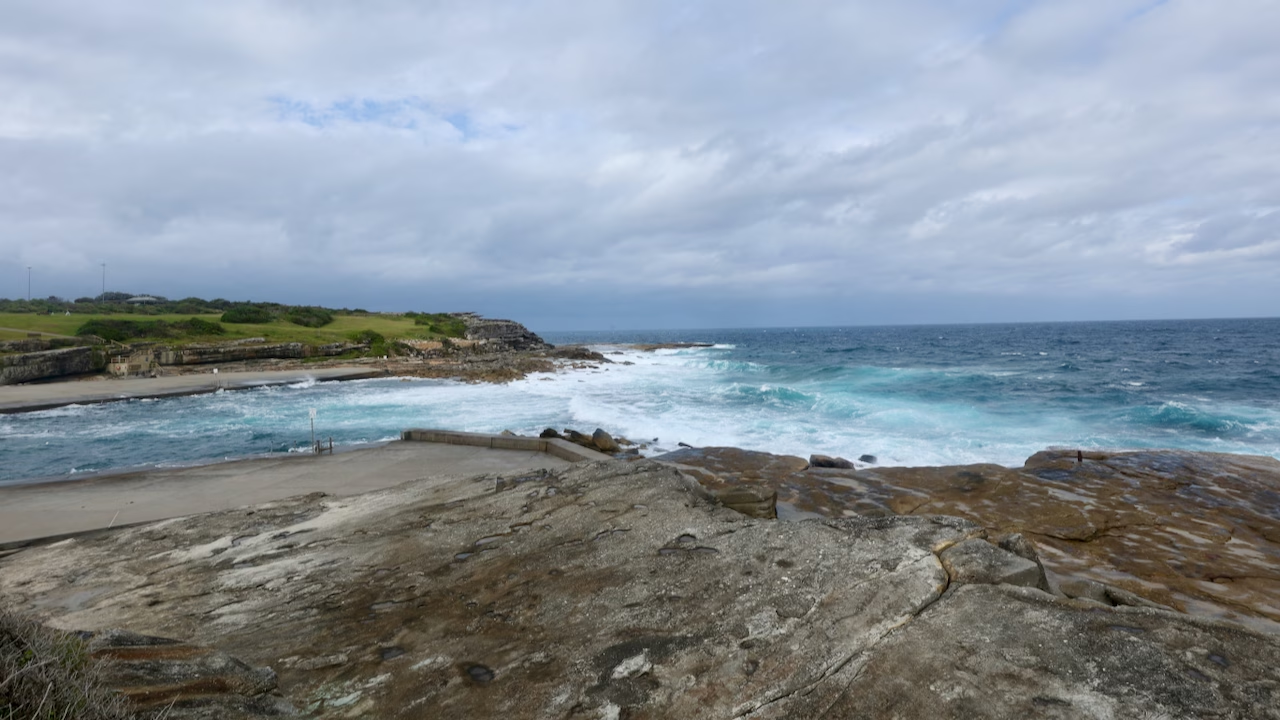
At the southern end of the boardwalk, the path reaches Ocean Street and Burrows Park, a big grassy clifftop park with views in every direction. Both of my walks ended here, from opposite directions, and I think it’s the most underrated stop on the whole route.
When I arrived from Coogee, the park was full of people: groups chatting on the grass, dog walkers, runners on the path, people using the outdoor gym. Part of the park is an off-leash dog area, and the Clovelly Bowling Club sits right in the middle of it. Being so exposed, it gets very windy, especially in the cooler months.
It’s also a good place to end the walk early. My evening walk finished at the bus stop on Ocean Street opposite the bowling club, a couple of minutes from the cemetery boardwalk.
Clovelly
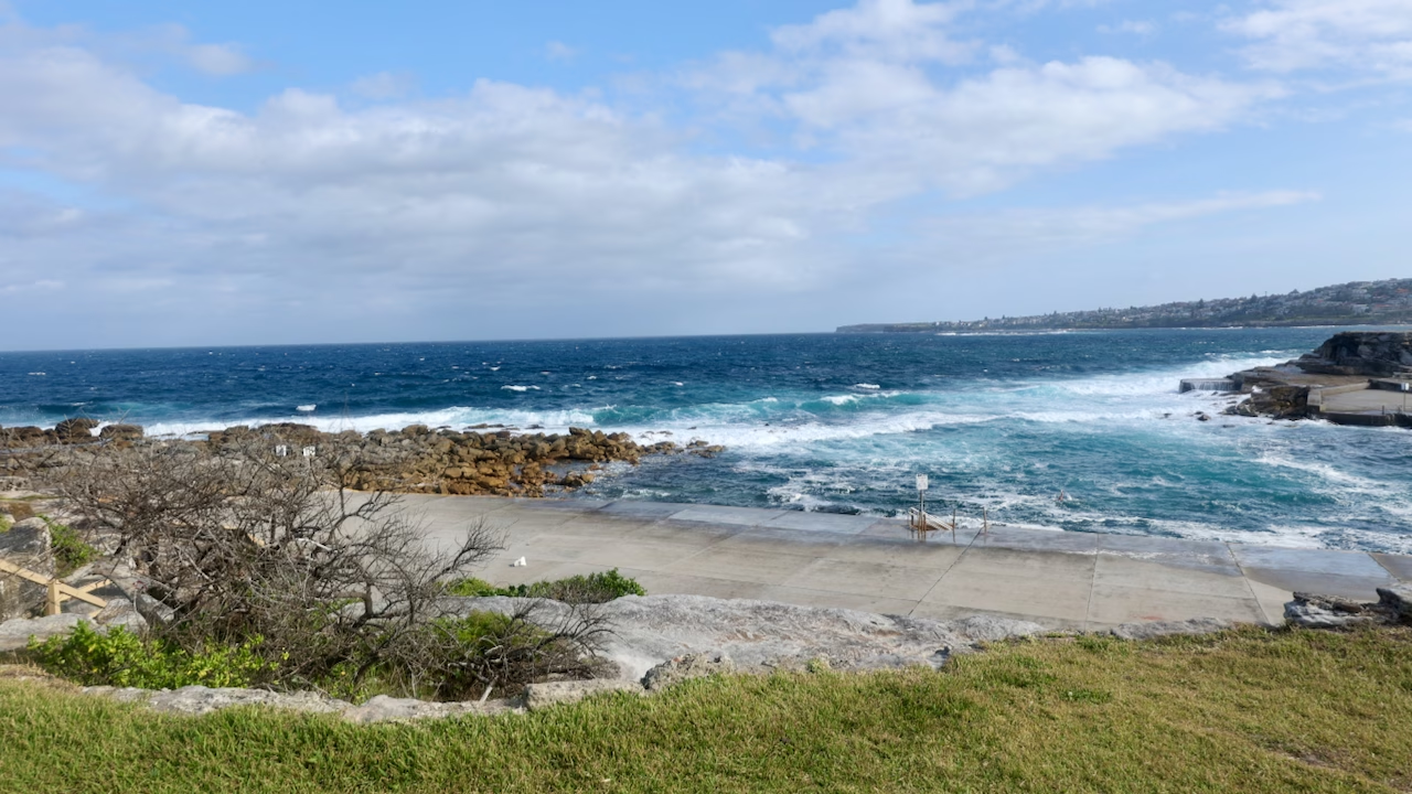
Clovelly doesn’t look like the other beaches. It’s a long, narrow inlet with wide concrete platforms running down both sides, so it feels more like a giant ocean pool than a surf beach. The water is sheltered and popular with snorkellers. On my walk, the swell was big enough that only one swimmer was in the water, hanging on near the ladder.
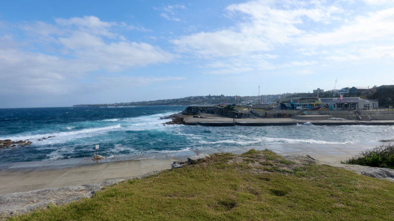
The surf club at the southern side has a colourful mural and there’s a café near the car park. From Clovelly, buses run to Central (route 339).
Gordons Bay
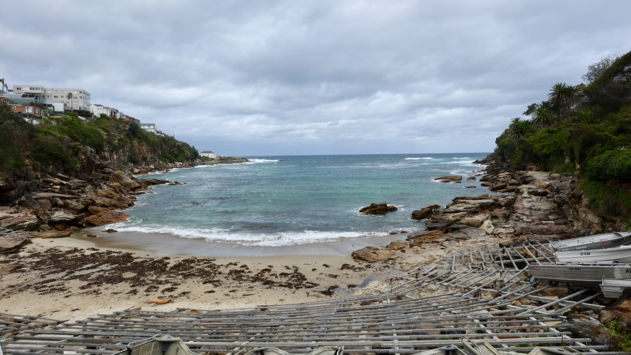
Gordons Bay was the biggest surprise of the walk. It’s not a swimming beach in the usual sense. The small strip of sand is covered in wooden racks, called skids, stacked with aluminium dinghies that belong to the local amateur fishing club. On a grey day, with seaweed on the sand and the boats lined up, it looked more like a fishing village than Sydney.
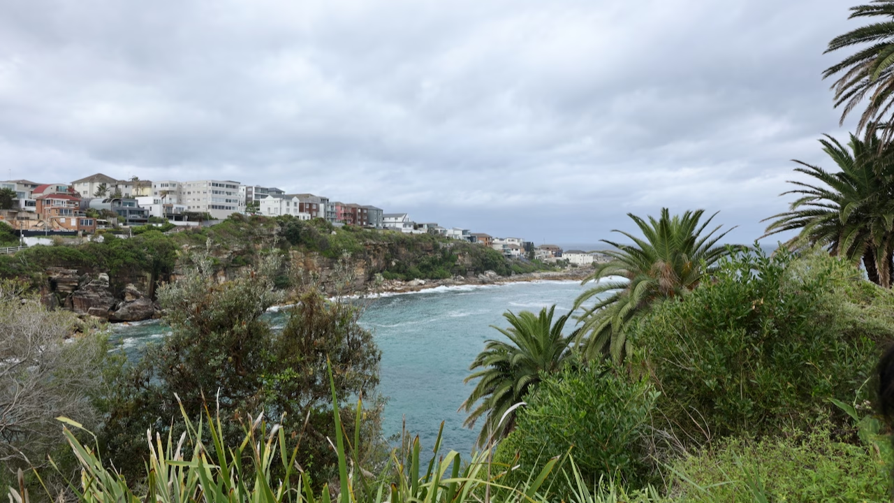
From above, the bay is a different picture: turquoise water framed by palms and sandstone cliffs. The bay is named after Lewis Gordon, a government surveyor granted land here in the nineteenth century. Under the surface is a 600-metre underwater nature trail for snorkellers and divers, marked by a chain linking concrete-filled drums about 20 metres apart, each with an information plaque about the sea life. Diving the trail takes about 40 minutes, and on a clear day you can follow it from the surface with a snorkel. Gordons Bay is unpatrolled and dogs are not allowed.
This is also the steepest section of the walk. The path climbs out of the bay on steep stairs, then follows Cliffbrook Parade and Major Street, residential streets, for a short distance. This is where I lost the signs a couple of times and had to find my own way back to the coast. If in doubt, keep the sea on your left (heading south) and you’ll pick the path up again.
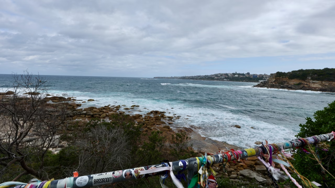
Look out for the railing along here plastered with stickers, festival wristbands and ribbons left by walkers from around the world.
Dunningham Reserve and Dolphins Point
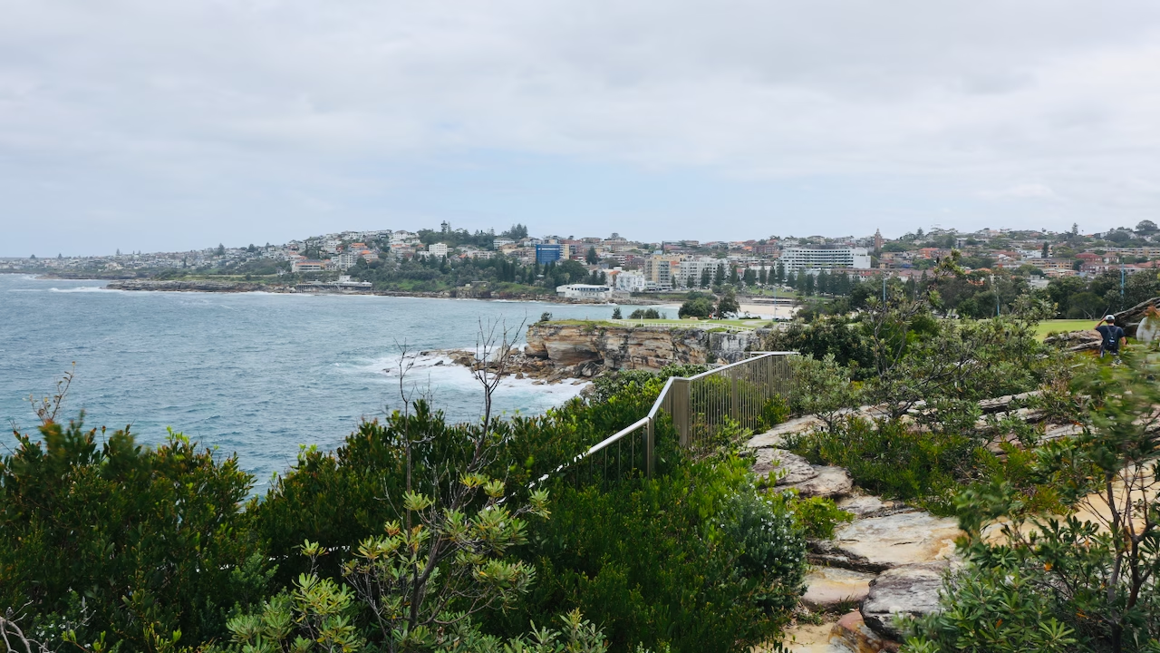
The last headland before Coogee is Dunningham Reserve, and for me it was the most dramatic part of the whole walk. The cliffs drop straight into the sea, the scrub is wild and windblown, and the views stretch along the coast in both directions.
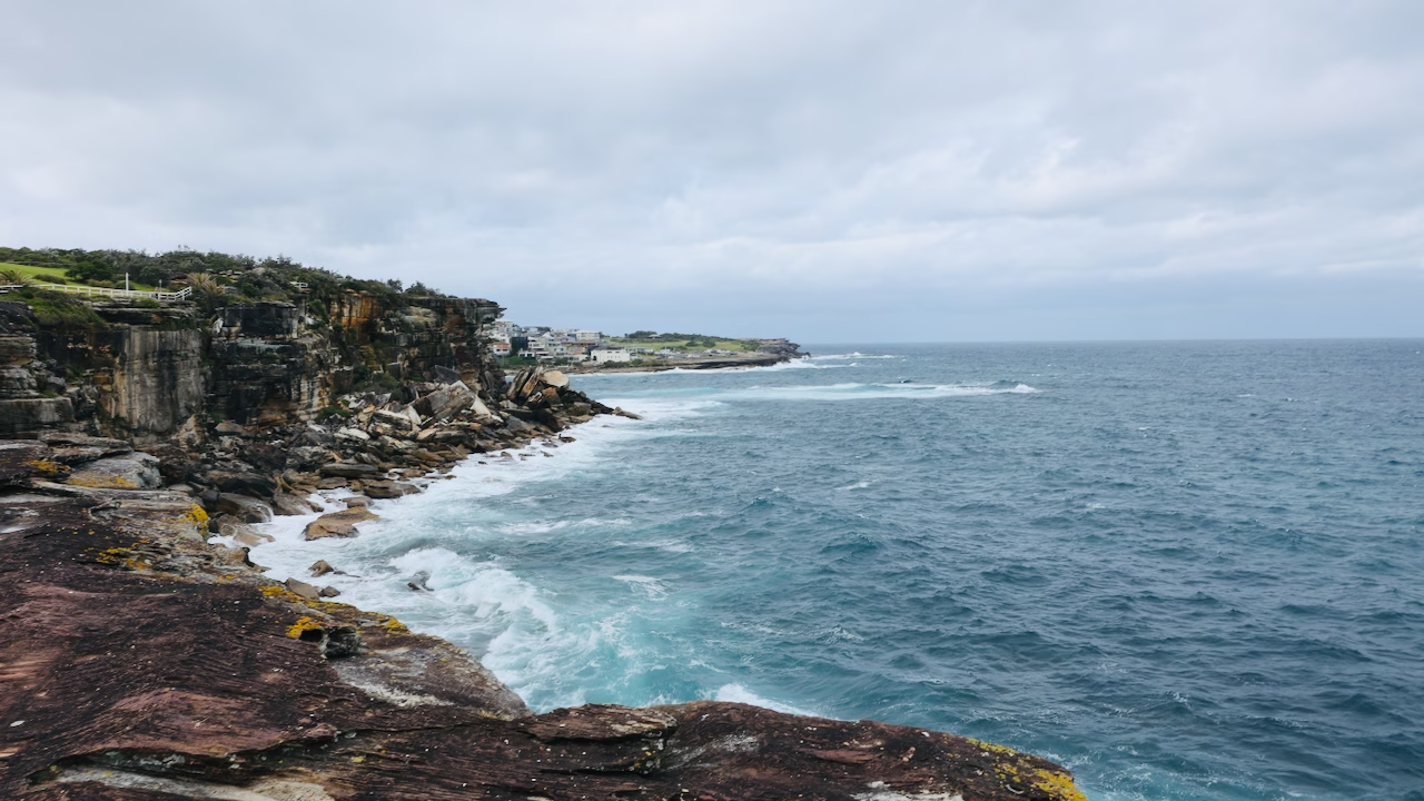
When I started my walk here, this section felt isolated and a bit hard going after the busy beach below. But standing on the headland, with sheer cliffs dropping into a rough sea and nothing but ocean in front of me, it reminded me of the coastline on the Great Ocean Road, on a much smaller scale. Several local guides recommend leaving the main path here and following the sandstone edge around the headland. If you do, stay back from the unfenced edges.
The headland at Dolphins Point holds the memorial to the victims of the 2002 Bali bombings. The point was renamed in 2003 in memory of six members of the Coogee Dolphins rugby league club who were killed in the attack.
Coogee Beach
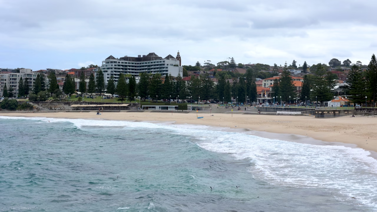
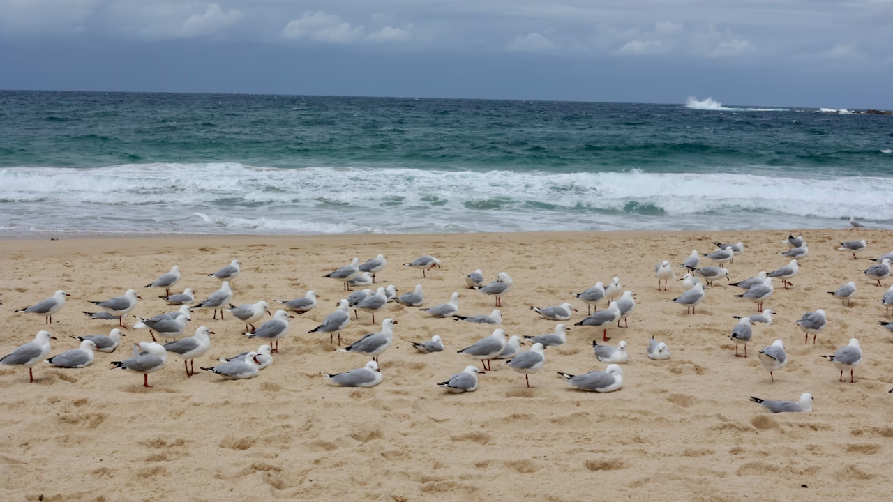
Coogee is where the walk ends, or begins. It’s a wide, sheltered beach with a big park, Norfolk pines along the promenade, and plenty of places to eat and drink, including the Coogee Pavilion. On the grey afternoon I started here, gulls had taken over half the sand and a “Dangerous Current” sign stood at the water’s edge.
Coogee’s history is stranger than it looks. In 1928 an English-style pleasure pier opened here, stretching 180 metres out to sea with a theatre and ballroom; the surf battered it so badly that it was demolished in 1934. The Coogee Pavilion stands on the site of the old Coogee Palace Aquarium, where in 1935 a captive tiger shark famously coughed up a tattooed human arm, sparking one of Sydney’s most notorious murder investigations.
Look out to sea and you’ll spot Wedding Cake Island, a rock platform about a kilometre offshore. It most likely gets its name from the way white spray coats it like icing on rough days. It shelters the beach from the worst of the swell, and it was famous enough to inspire a Midnight Oil surf instrumental of the same name. Coogee is also known for a dangerous shore break, so swim between the flags here too. If you’d rather avoid the surf, Coogee has rock pools at both ends of the beach: Giles Baths at the northern end, below Dolphins Point, and the Ross Jones Memorial Pool at the southern end, near the surf club. Buses 373 and 374 run from Coogee to the city.
Walking It the Other Way: The Coogee to Bondi Walk
To do the Coogee to Bondi walk, start at the north end of Coogee Beach and follow the coast north. Here’s the route:
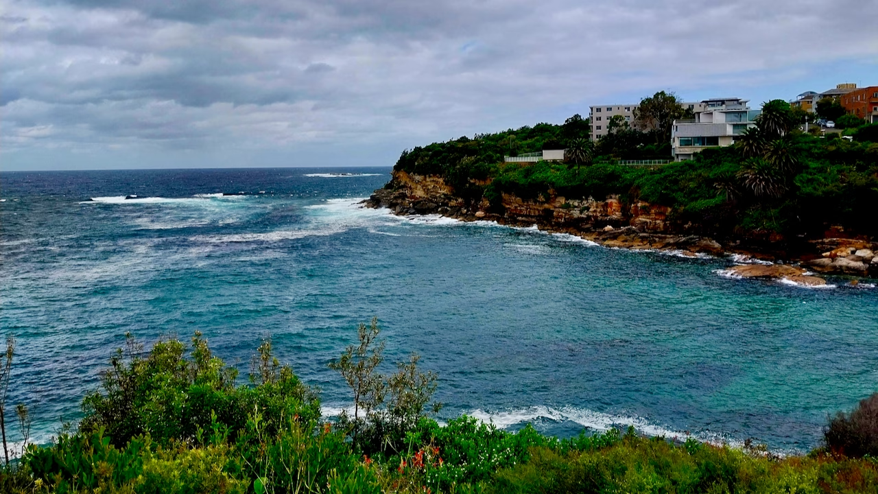
The Coogee end has the toughest climbs, so going this way gets them done while you’re fresh. My Coogee walk took me a little under 50 minutes from Coogee Beach to Gordons Bay, including plenty of photo stops.
The Bondi to Bronte Walk (the Short Version)
If you only have an hour or two, walk from Bondi to Bronte. It’s about 3 km and takes 45 minutes to an hour, and it covers the best-known part of the walk: the Icebergs, the clifftops at Marks Park, Tamarama and Bronte. Many people walk it as an out-and-back, Bondi to Bronte and return, which makes it about 6 km in total.
If you’d rather not walk back, there’s a bus stop on Bronte Marine Drive, and Bronte has buses to Bondi Junction.
Other shorter versions and bail-out points
You don’t have to walk the whole thing. The path links five beaches and buses stop at every one of them, so there are plenty of ways to shorten it. Besides Bondi to Bronte, these are the options I’d suggest:
About 3.6 km and around 50 minutes of walking: the cemetery boardwalk, Clovelly, Gordons Bay and the Coogee headland.
What I did on my evening walk, including the cemetery boardwalk. Catch the bus on Ocean Street, opposite the Clovelly Bowling Club.
What I did on my afternoon walk: Dunningham Reserve, Gordons Bay and Clovelly.
About 12 km for keen walkers. Allow 4 to 5 hours with stops.
Best Time to Walk: Sunrise, Sunset and Seasons
The best time to do the Bondi to Coogee walk is early morning or late afternoon, on a weekday. Mornings are cool and quiet, with the sun rising over the ocean; late afternoons bring golden light and a pink afterglow at dusk. Avoid 10am to 3pm in summer, when there’s little shade.
Bondi to Coogee walk at sunrise
Early morning is cool, and the path belongs to runners rather than people stopping for photos. Because this coast faces east, the sun rises over the ocean, which makes sunrise the one time you’ll see the sun on the water from this walk. Several walkers who reviewed the walk describe starting early at Coogee and watching the sun come up over the cliffs. If that’s your plan, start at Coogee and walk north, so the light is on Bondi Beach when you arrive.
Bondi to Coogee walk at sunset and dusk
Late afternoon into dusk is when I did the Bondi walk, and I’d do it again. The light turns gold over Bondi, the crowds thin out by Tamarama, and as the beaches go blue and the lights come on, a pink band spreads low over the ocean.
Does the Bondi to Coogee walk have an ocean sunset? No. The coast faces east, so the sun sets behind the suburbs. The reward at dusk is a golden glow over Bondi and a pink afterglow over the sea. For the sun on the water, come at sunrise.
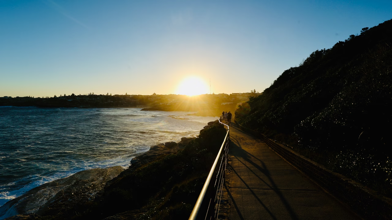
On summer evenings the sun sets in the south-west, so if you’re heading towards Coogee late in the day you’ll walk straight into it for a while. That’s exactly what happened to me near Marks Park, and it gave me my favourite photo of the walk, the one at the top of this page.
Walking in the dark
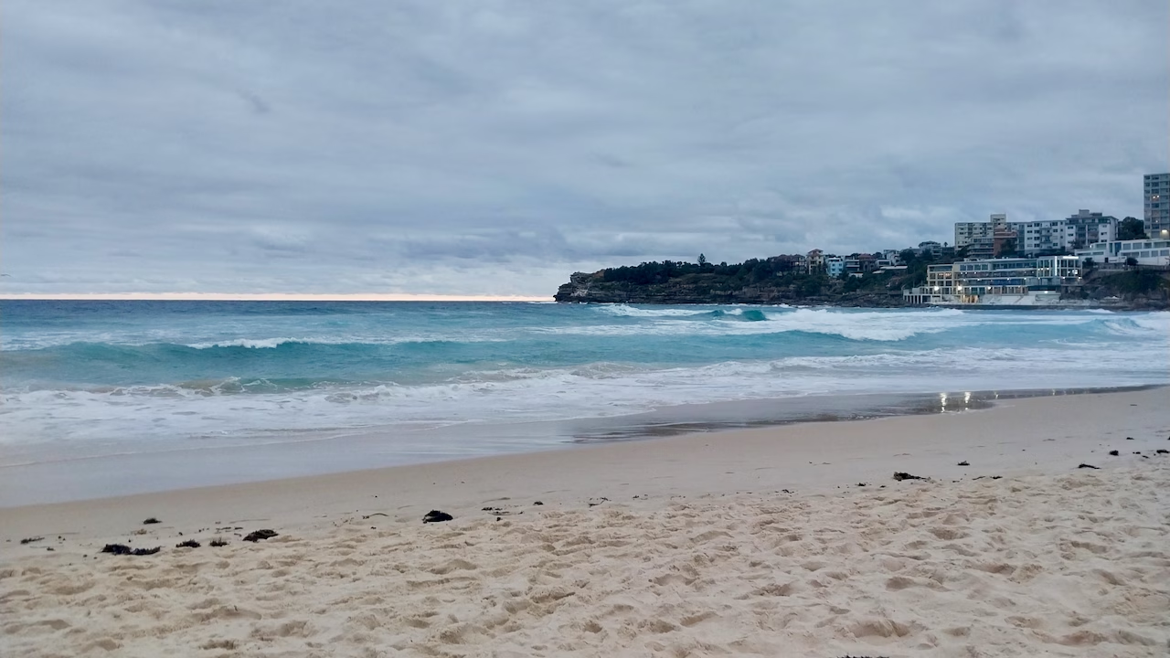
The beachside streets at Tamarama and Bronte have streetlights, but the clifftop stretches don’t, and the Waverley Cemetery boardwalk gets properly dark. I reached it as night fell, which was memorable but slow going. If you start at Bondi in the late afternoon, plan to finish at Bronte or Burrows Park before the light goes. A phone torch is a backup, not a plan. The path also empties quickly at dusk, as I found at Tamarama.
Midday, weekends and cafés
In summer, many walkers say they regretted setting off between 10am and 3pm, when there’s almost no shade. Weekends, especially sunny ones, get busy enough that some reviewers describe queues at narrow points of the path, so go on a weekday if you can. And if you’re planning a late walk, note that many cafés aimed at locals close around 3pm.
Time of year
The walk is good year-round. In winter the path is quieter and the light is softer all day, but the exposed clifftops can be cold and very windy, so bring a layer. From May to November you have a chance of seeing humpback whales from the headlands, and in spring Sculpture by the Sea fills the Bondi to Tamarama stretch with art and people.
Sculpture by the Sea
For about three weeks every spring, the Bondi to Tamarama section becomes the world’s largest free-to-the-public outdoor sculpture exhibition, with around 100 works along the clifftops. The show was founded by David Handley and first held here in 1997. In 2026, Sculpture by the Sea runs from 16 October to 2 November.
In 2026 the exhibition celebrates 30 years, and Transport NSW expects around 450,000 visitors over its 18 days. It’s a fun time to do the walk, but expect crowds and queues for buses, especially at weekends. Go on a weekday, early or late in the day, and use public transport: weekend clearways and daily road closures around Bondi, Tamarama and Bronte make driving miserable. Transport NSW publishes travel advice for the event each year. Details are on the official Sculpture by the Sea website.
Best Photo Spots on the Walk
Of all the searches people make about this walk, “photos” is one of the most common, so here are the spots where I took my favourite shots:
Notts Avenue above the Icebergs. The classic shot of the turquoise pool against the dark ocean, best when the swell is up.
The clifftop ten minutes south of Bondi. The look back over the whole beach.
Marks Park and Mackenzies Point. Big ocean views and surf breaking on the ledges.
The headland between Tamarama and Bronte. Looking back over Tamarama, best at dusk.
The Waverley Cemetery boardwalk. Headstones above, surf below. Try a long exposure at dusk if you carry a tripod.
Gordons Bay from the clifftop. Turquoise water, palms and the boat racks below.
Dunningham Reserve. Wild cliffs and the view back over Coogee.
Getting There and Back: Buses, Trains and Parking
The walk is one way, so you’ll need transport at one end. Public transport is far easier than driving, as parking at both Bondi and Coogee is scarce and expensive. Most Sydney buses don’t take cash, so tap on with an Opal card or a contactless bank card.
Getting to Bondi from the city
Take bus 333 from Circular Quay, which runs to Bondi Beach via Bondi Junction. Or take the T4 train to Bondi Junction and change to a bus for the short ride to the beach. Get off at the first stop on Campbell Parade, opposite Notts Avenue, and you’re at the start of the walk.
Getting to Coogee from the city
Buses 373 and 374 run between Coogee Beach and the city. If you’re coming from UNSW or Randwick, the L2 light rail goes to Randwick, from where the 373 continues down to Coogee.
Buses along the way
| Where | Buses | Good for |
|---|---|---|
| Bondi Beach | 333 to the city via Bondi Junction | Start or finish |
| Tamarama Marine Dr | 381 loop to Bondi Junction | Ending at Tamarama |
| Bronte Marine Dr opp Hewlett St | 362 towards Coogee (weekends in the warmer months), 381 to Bondi Junction (from the stop sign in my photo) | Ending at Bronte |
| Ocean St, North Clovelly (by Burrows Park) | 360 to Bondi Junction | Ending at Burrows Park |
| Clovelly Beach | 339 to Central | Ending at Clovelly |
| Coogee Beach | 373 and 374 to the city; 362 to Bondi Beach (weekends in the warmer months) | Start or finish |
Getting between the two ends matters if you’ve parked at one of them. Route 362 runs directly between Coogee and Bondi Beach via Bronte and Tamarama, continuing on to Rose Bay, but only on weekends during the daylight saving months, roughly every two hours (with extra services during Sculpture by the Sea). The rest of the time there’s no direct bus, so most trips change at Bondi Junction and take around 40 minutes in total.
Routes and timetables change, and extra or diverted services run during big events like Sculpture by the Sea, so check the Transport NSW trip planner on the day.
Parking at Bondi and Coogee
If you have to drive, expect a hunt. Parking near both beaches is limited, mostly metered or time-restricted, and fills early on warm weekends. Because the walk is one way, you’ll also need to get back to your car, so the easiest option is to park at one end and catch the bus back from the other. On a sunny weekend I’d leave the car at home at either end.
Making a day of it with Watsons Bay
If you have a full day, combine the walk with a morning at Watsons Bay. Take the ferry from Circular Quay to Watsons Bay in the morning, walk out to Hornby Lighthouse, then catch the 380 bus, which runs from Watsons Bay to Bondi Beach, and do the coastal walk in the afternoon.
Practical Tips for the Walk
Heat, shade and what to bring
There’s very little shade between the beaches and no water on the headlands, so dress for sun and carry a bottle you can refill at each beach.
What to bring:
- Hat, sunscreen and sunglasses
- A refillable water bottle (fountains at every beach)
- Comfortable trainers; the path is paved
- Swimmers and a towel for the ocean pools
- An Opal card or contactless bank card for the bus back
- A torch or phone light if you’re walking at dusk
- A light layer for the windy headlands
Toilets, water and showers
There are public toilets and drinking fountains at every beach. The council sign at Tamarama lists toilets and change rooms at each beach, and that matched what I found. The Bondi Pavilion also has showers if you want to rinse off after a swim.
Phone signal and weather
The whole walk runs close to the suburbs, so mobile reception is generally reliable, but don’t rely on your phone as your only light or map after dark. The headlands are fully exposed. In wet weather the sandstone steps get slippery, and on windy days places like Burrows Park and Dunningham Reserve can be blustery enough to make you think twice about the unfenced edges. If a storm rolls in, cut inland to the nearest bus stop; you’re never more than a few minutes from one. Grey weather is no reason to stay home. I walked the Coogee half under heavy cloud with the wind whipping the sea white, and the Coogee headland was still the most beautiful part of the walk for me.
Bondi to Coogee walk with kids
Older children cope well; one reviewer’s 15-year-old found it easy. Younger kids will want plenty of beach stops. The stairs rule out prams for the full route, so plan on a carrier for toddlers. The beaches break the walk into short, rewarding chunks, and there are fenced playgrounds along the way, including one at Dunningham Reserve above Coogee. For a shorter family outing, Bondi to Bronte with a picnic in Bronte Park is ideal.
Swimming safety
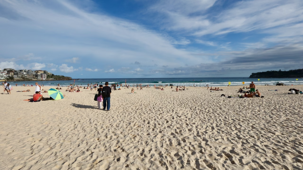
The flags matter here, and Bondi learned that the hard way. On 6 February 1938, a hot Sunday that drew around 35,000 people to the beach, three huge waves swept hundreds of swimmers out to sea. Lifesavers pulled around 250 people from the water in one of the largest mass rescues in Australian history, but five people drowned. It became known as Black Sunday. Today, council lifeguards patrol the busier beaches and volunteer surf lifesavers patrol on weekends and public holidays.
Swim between the red and yellow flags. Bondi, Tamarama, Bronte, Clovelly and Coogee are patrolled. Gordons Bay is not. The beaches on this coast have strong rips, including the Backpackers’ Express at the south end of Bondi and the Bronte Express at the south end of Bronte. If you’d rather avoid the surf, use one of the ocean pools listed below. Check conditions for each beach on Beachsafe before you swim.
Ocean pools along the walk
If the surf looks rough, these are the places to swim instead:
| Pool | Where | Entry |
|---|---|---|
| Bondi Icebergs | South end of Bondi, at the start of the walk | Paid (around $10), sauna included |
| Bronte Baths | South end of Bronte Beach | Free |
| The Bogey Hole | Rock shelf at the south end of Bronte | Free, natural rock pool |
| Giles Baths | North end of Coogee, below Dolphins Point | Free, rock pool open to the surf |
| Ross Jones Memorial Pool | South end of Coogee, near the surf club | Free |
Clovelly isn’t an ocean pool, but its long, narrow inlet is sheltered enough to swim and snorkel in on calm days.
Cafés and food along the walk
I didn’t stop to eat on either walk, so these come from Destination NSW and other guides rather than my own experience. Check opening hours before you rely on any of them, as many local cafés close mid-afternoon.
- Bondi: The Crabbe Hole, a small café tucked below the Icebergs pool.
- Tamarama: A café at the back of the beach, handy for a coffee and water refill.
- Bronte: The café strip behind the park, including local institutions The Bogey Hole Café and Iggy’s Bread. The best lunch stop on the walk.
- Clovelly: Seasalt café by the beach, and the Clovelly Hotel, a restored pub with a beer garden, a few minutes from the water.
- Coogee: The Coogee Pavilion for pizza and a rooftop drink at the finish, plus plenty of cafés along the promenade.
Dogs
Destination NSW says dogs are allowed on the walk on a lead, but rules vary by beach and reserve. Burrows Park has an off-leash area, but dogs are prohibited at Gordons Bay, so plan around that if you’re walking with one.
Path etiquette
The path narrows in places, and locals use it as a running track, especially early in the morning. Keep left and be ready to step aside.
Guided Walks, Tours and Surf Lessons
The links below are affiliate links. If you book through them, I may earn a small commission at no extra cost to you.
The walk is easy to do on your own, but a guided walk adds the local history and Aboriginal stories behind the places you pass. If you’d rather be in the water than above it, Bondi is also one of the best places in Sydney for a first surf lesson.
Where to Stay Near the Walk
Where you stay depends on what else you want from Sydney:
Bondi: for beach life
The most choice, from hostels to beachfront hotels, and the busiest beach scene. Walk out of your door and onto the path.
Coogee: for quieter evenings
Hotels overlooking the beach, a more relaxed pace and an easy finish to the walk.
Bondi Junction: for transport
Less glamorous but practical. It’s the end of the T4 train line, with buses to both ends of the walk.
The city centre: for a longer trip
Best if the walk is one day of a bigger Sydney stay. Bus 333 runs from Circular Quay to Bondi, and buses 373 and 374 to Coogee.
Useful Official Links
- Destination NSW: Bondi to Coogee Coastal Walk
- Transport NSW trip planner
- Beachsafe beach conditions
- Sculpture by the Sea
Bondi to Coogee Walk FAQ
These are the questions people ask most about the walk, answered from my two walks and the official sources.
/
Where does the Bondi to Coogee walk start?
At Notts Avenue, at the south end of Bondi Beach beside the Bondi Icebergs pool. If you’re walking the other way, start at the north end of Coogee Beach and follow the path up onto the headland at Dolphins Point.
How long is the Bondi to Coogee walk?
The walk is about 6 km one way. You’ll see figures from 5.5 km to 6.5 km quoted, depending on where each guide starts and stops measuring.
Is the Bondi to Coogee walk free?
Yes. It’s a public coastal path with no tickets or fees. The only costs are optional: entry to the Bondi Icebergs pool (around $10), food along the way and your bus fare.
How long does the Bondi to Coogee walk take?
About 90 minutes of non-stop walking. With photo stops, a swim or a coffee, allow 2 to 3 hours.
Which direction is best, Bondi to Coogee or Coogee to Bondi?
Finish where you want to spend the rest of the day. Walk Coogee to Bondi if you want to end on Bondi Beach or watch the sunrise. Walk Bondi to Coogee if you want the classic views back over Bondi first, the sun behind you for much of the day, and a quieter finish.
Which beaches does the Bondi to Coogee walk pass?
Five beaches: Bondi, Tamarama, Bronte, Clovelly and Coogee. You also pass two bays, Mackenzies Bay and Gordons Bay. Gordons Bay has a small strip of sand, which is why some guides say the walk passes six beaches.
Is the Bondi to Coogee walk hard?
It isn’t difficult, but it isn’t flat either. The path is paved and Destination NSW rates it Grade 2, suitable for most ages and fitness levels, but there are many sets of stairs and the climbs around Gordons Bay are steep. Take it at your own pace and it’s very manageable.
Can you do the Bondi to Coogee walk at sunrise or sunset?
Yes, both work. At sunrise the sun comes up over the ocean, so start at Coogee and walk north. At sunset the sun goes down behind the city, not the sea; you get golden light at Bondi and a pink afterglow over the water. The stretch past Waverley Cemetery gets dark quickly, so plan to finish at Bronte or Burrows Park before it’s fully dark.
How do you get back after the Bondi to Coogee walk?
By bus. From Coogee, buses 373 and 374 run to the city. From Bondi, bus 333 runs to the city via Bondi Junction. On weekends in the warmer months, route 362 links Coogee and Bondi Beach directly. There are also bus stops at Tamarama, Bronte, Clovelly and Burrows Park if you want to finish early.
How do I get to the Bondi to Coogee walk from Sydney CBD?
Take bus 333 from Circular Quay to Bondi Beach, or the T4 train to Bondi Junction and a bus to the beach. To start at Coogee, take bus 373 or 374 from the city.
Is the Bondi to Coogee walk suitable for beginners?
Yes, for anyone reasonably active. The path is paved and easy to follow, but it isn’t flat, and there’s little shade. If you’re unsure, walk Bondi to Bronte first: it’s about 3 km, and there’s a bus stop at Bronte if you decide that’s enough.
Is there a shorter version of the walk?
Yes. Bondi to Bronte is about 3 km and takes 45 minutes to an hour. It covers the Icebergs, Marks Park, Tamarama and Bronte.
Are there toilets and water along the walk?
Yes. There are public toilets and drinking fountains at every beach: Bondi, Tamarama, Bronte, Clovelly and Coogee.
What shoes should you wear for the Bondi to Coogee walk?
Trainers or comfortable walking sandals. The path is paved, but there are many stairs, and the sandstone gets slippery when wet. You can do it in flip-flops, but they’re hard work on the steeper steps around Gordons Bay.
Can you swim along the Bondi to Coogee walk?
Yes. Bondi, Tamarama, Bronte, Clovelly and Coogee are patrolled beaches, so swim between the red and yellow flags. For calmer water, use the ocean pools at Bondi Icebergs and Bronte Baths, or the sheltered water at Clovelly.
Can you see whales on the Bondi to Coogee walk?
Yes, in season. Humpback whales pass Sydney from May to November, with the peak of the northern migration in late June and early July. The high headlands are the best lookouts: Marks Park and Mackenzies Point near Bondi, and Dunningham Reserve near Coogee.
Is the Bondi to Coogee walk safe at night?
The path itself is safe, but the clifftop sections and the Waverley Cemetery boardwalk aren’t lit, and the edges drop straight into the sea. Walking it at dusk is fine if you finish at Bronte or Burrows Park before full dark; I wouldn’t walk the unlit cliffs at night.
What’s the best time of year for the Bondi to Coogee walk?
Any time. Spring and autumn are the most comfortable, summer is best early or late in the day to avoid the heat, and from May to November you might see humpback whales from the headlands.
Can you bring a dog on the Bondi to Coogee walk?
Yes, on a lead. Burrows Park has an off-leash area, but dogs are not allowed at Gordons Bay.
Can you do the walk with a pram or wheelchair?
Not the full walk. There are too many stairs. Some sections, such as the promenades at Bondi and Bronte, are accessible on their own.
What is the most beautiful walk in Sydney?
It’s one of Sydney’s most popular coastal walks, and it’s the one I’d recommend first. In 6 km it passes five beaches, ocean pools, sandstone cliffs, Aboriginal rock engravings and a clifftop cemetery, and it’s free and easy to reach by bus.
Can you walk the Bondi to Coogee walk both ways?
Yes. The return walk is about 12 km. Allow 4 to 5 hours with stops. Most people walk one way and take the bus back.
Is the walk pram or wheelchair friendly?
Not as a complete route. Destination NSW lists the walk as not suitable for prams or wheelchair users, mainly because of the stairs. Some sections are accessible on their own, including the promenades at Bondi and Bronte. Older walkers manage it fine at their own pace; several reviewers in their sixties describe the stairs as challenging but doable.
Final Thoughts
You don’t have to walk it in one go, and you don’t need perfect weather. My grey, windy afternoon from Coogee and my golden evening from Bondi felt like two different walks. Start at whichever end appeals, see how far the views pull you, and when you’ve had enough, there’s a bus stop round the corner.
For more walks, road trips and city guides around the country, browse my Australia travel guides.

Leave a reply