
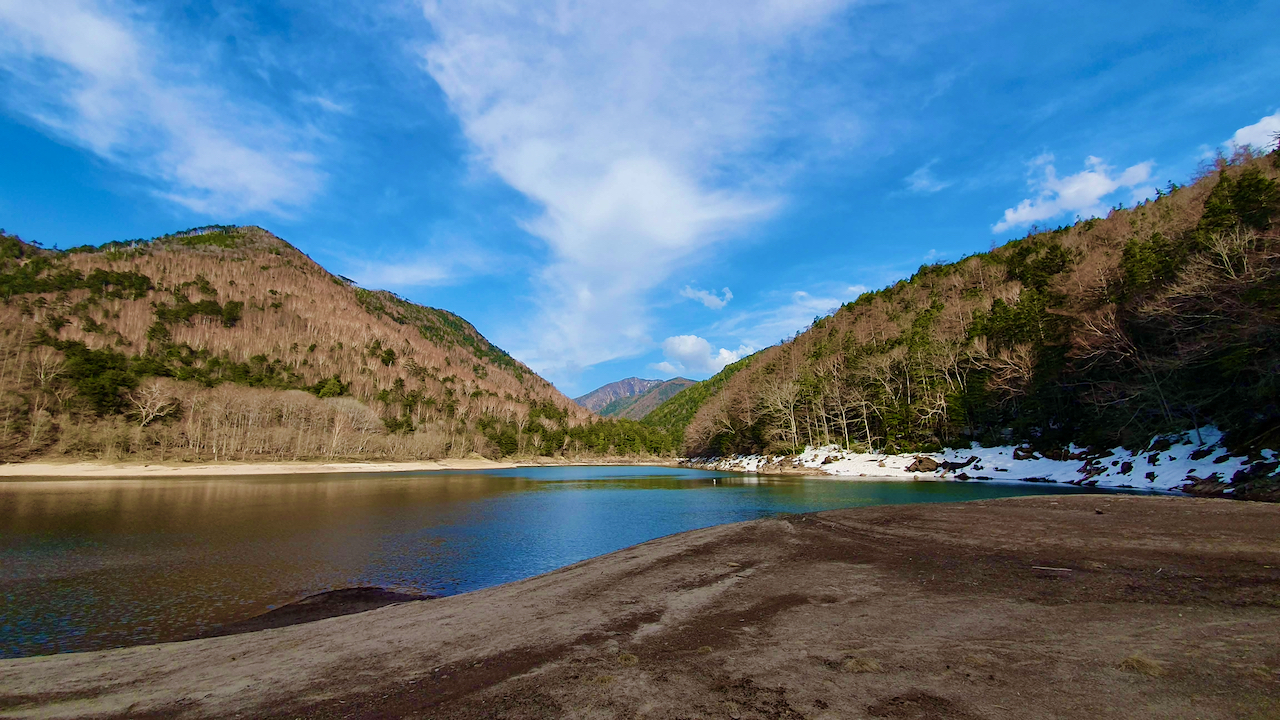
Karikomi Lake (刈込湖), also written Lake Karikomi (and sometimes searched as Lake Komi), is a quiet emerald lake in Nikko National Park, reached by a forest trail from Yumoto Onsen. The Nikko tourism board puts it about 70 minutes on foot from the trailhead, which makes it one of the easiest ways to get away from the crowds around Tosho-gu and Kegon Falls. This guide covers the route, times, bus access, bear safety and what it was like when I walked it in snow in May.
✅ SHORT ANSWER
From Yumoto Onsen, Lake Karikomi is about 70 minutes on foot each way on a moderately challenging forest trail, and Lake Kirikomi is another 20 minutes beyond it. The full trail to the Kotoku side is about 10 km and takes roughly 3.5 to 4.5 hours one way. Take a morning bus (about 1 hour 20 minutes from Nikko) and check the last bus back before you start.
This is also where I had one of the most memorable hiking experiences of my life in Japan, stumbling through snow in May, with no phone signal and growing concern about bears, toward a lake I could not see until I was almost standing beside it.
This article covers both: the practical trail guide you need to plan the hike, and an account of what it was actually like.
Trailhead
Yumoto Onsen
Last stop on the Tobu Bus from Nikko
To Lake Karikomi
About 70 min
Plus about 20 min on to Lake Kirikomi
Full trail
About 10 km, +300 m
Yumoto to the Kotoku side, 3.5 to 4.5 hours
Difficulty
Moderate
Steep stepped sections near each end
From Nikko Station
About 1 h 20 by bus
Tobu Bus, JR or Tobu-Nikko Station
Season
Late spring to autumn
Snow can linger into May
Bears
Present
Oku-Nikko is Asian black bear habitat
About Karikomi Lake and Its Twin
Lake Karikomi and its neighbour Lake Kirikomi sit in the Okunikko area, far from the World Heritage temples of central Nikko. Lava blocked the outflow of water from the surrounding mountains many centuries ago and formed the lakes. They connect to each other except in periods of very little rain, reach about 15 metres deep in places, and have no visible streams flowing out, so the water presumably drains underground.
The names carry a legend. Local people once feared a giant serpent living near the lakes. Shodo Shonin (735 to 817), the monk credited with founding Nikko’s temples and shrines, is said to have confronted it, killed it and buried its body in the water. The names honour that deed: kiri means to cut, kari means to hunt and komi means to push down.
The setting is dense old forest and mossy volcanic rocks, with shaded paths and cool mountain air, which is why the lakes feel so far removed from the Tosho-gu crowds.
The Trail: What You Need to Know
Starting Point
The trailhead is at Yumoto Onsen, the last stop on the Tobu Bus route from Nikko (about 1 hour 20 minutes; see Practical Information below for passes and timetables). If you drive, Yumoto has a free prefectural car park with about 100 spaces.
Two Versions of the Hike
Option 1: out-and-back to the lakes (recommended for most visitors)
- Time to Lake Karikomi: about 70 minutes each way
- Lake Kirikomi: about 20 minutes further each way
- Total: roughly 3 to 4 hours including the return and a rest at the water (my estimate from the official times)
- Start and end: Yumoto Onsen
Option 2: the full trail to the Kotoku side
- Distance: about 10 km, with about 300 m of climbing
- Time: roughly 3.5 to 4.5 hours (the stage times below add up to about 3 hours 50 minutes, and the Nikko Yumoto Visitor Center gives 4.5 hours or more)
- Stages: Yumoto to Lake Karikomi 70 min, to Lake Kirikomi 20 min, to Karenuma 50 min, to Kotoku Farm 70 min
- Start: Yumoto Onsen. End: the Kotoku side, where buses back to Yumoto are limited, so check the last bus before you start
💡 Why do the full trail? Karenuma, a dry marsh on the Kotoku side, is known for alpine flowers in early summer and colourful foliage in autumn. The trade-off is logistics: you finish away from where you began and depend on a limited bus, so I would only attempt it with a morning start. This part follows the official Nikko tourism pages.
What the Trail is Like
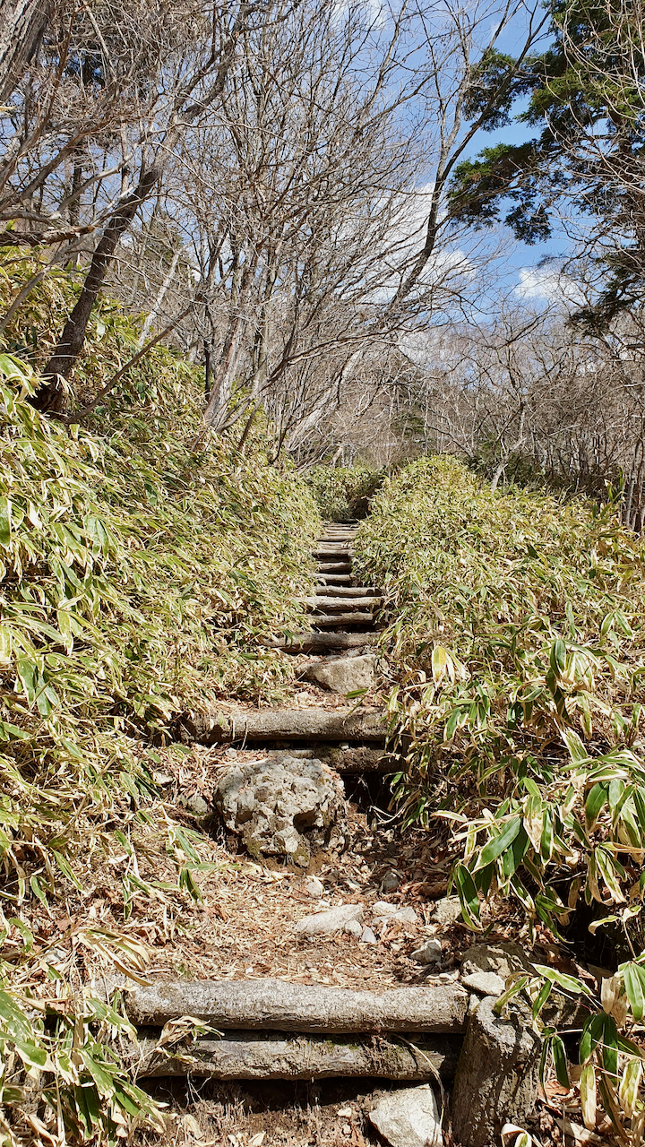
The trail circles Mt. Mitsudake (1,945 m) through old forest that includes Japanese elkhorn cedar. The topsoil is shallow, so many tree roots run across the path, and much of the western and northern side stays in shadow.
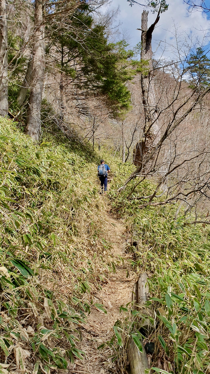
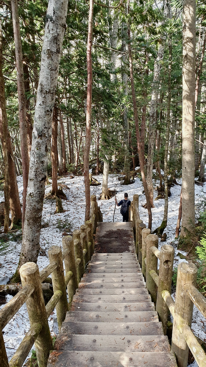
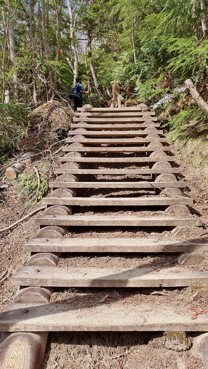
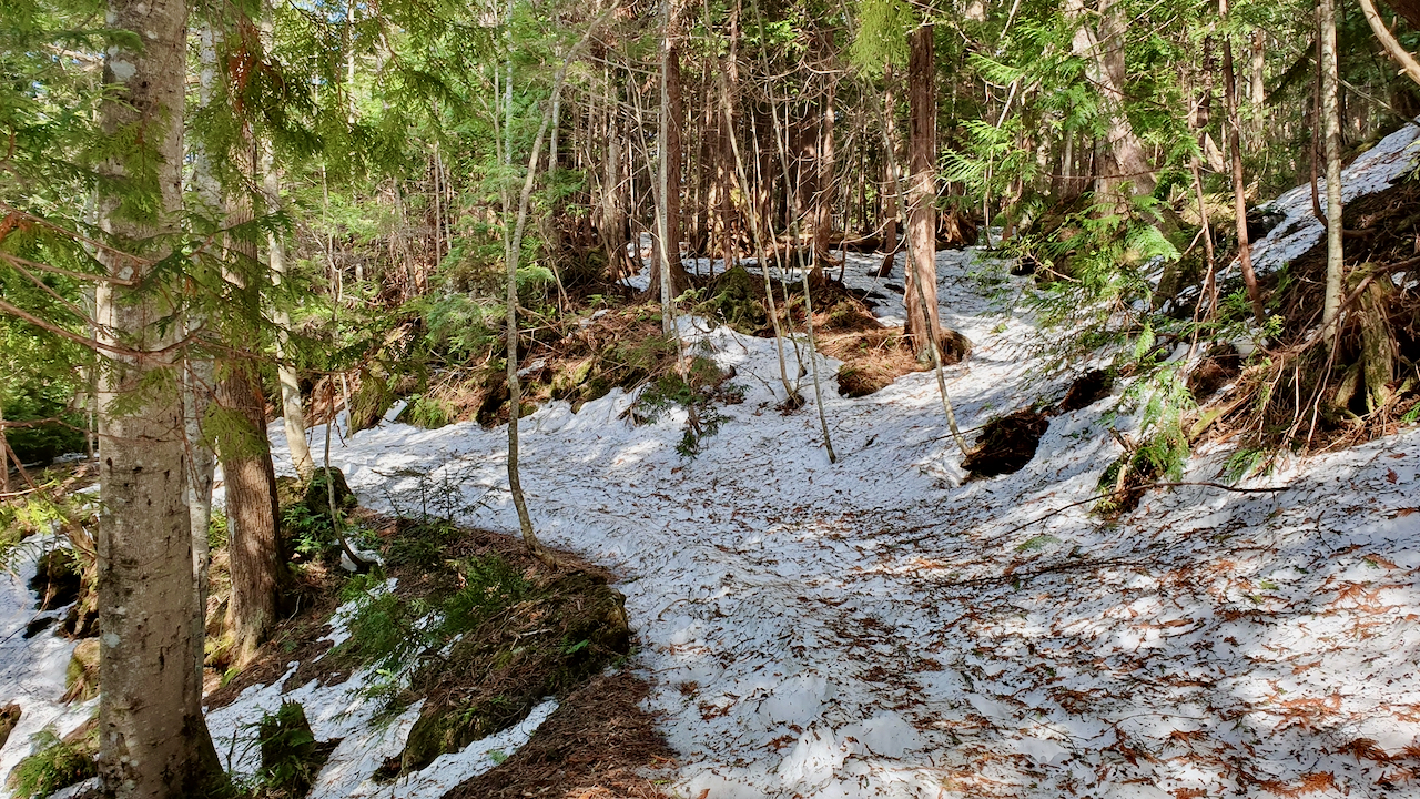
Official sources describe the path as well maintained, with benches along the way, and I crossed several wooden bridges and flights of steps. Snow changed that picture for me: in May the route was hard to read in places and the footing was slippery. A downloaded offline map is useful.
On the western and northern slopes, cool air sometimes flows from crevices and caves in the volcanic rock, which is a welcome bonus on a warm day.
💡 Note for 2026 and 2027 visitors: The Akechidaira Ropeway near Lake Chuzenji has been closed for a major renewal since 16 January 2026 and is expected to reopen around September 2027, according to the Nikko tourism site. If you were counting on the ropeway view, this forest walk is a different way to see Okunikko, but it is a hike, not a viewpoint.
Difficulty
Moderate. The official Nikko guide rates it moderately challenging, and the steepest stepped sections are near each end of the full trail. The route climbs about 300 m over its full length. The terrain is uneven and the roots need attention. Snow and ice made my May walk harder than it would be in summer, so treat the season as part of the difficulty.
⚠️ START EARLY
I began at about 2 pm after lunch, with no obvious signboard at the start, snow underfoot and the light fading, and I would not repeat that. The official Nikko guidance is to start in the morning. Allow about 70 minutes each way to Lake Karikomi, add a daylight margin and decide on a turn-around time before you set out.
My Personal Account: What It Was Actually Like
I crossed the road and looked at a steep ascent. You can expect a wooden signboard somewhere in this situation (that’s what Japan is all about: system!) But this time, I didn’t find any. It was already 2 pm. We had just completed our lunch, me and a buddy of mine. Hesitantly, we agreed to climb. This is how our hike to Karikomi Lake in Japan started.
Beginning of the Hike
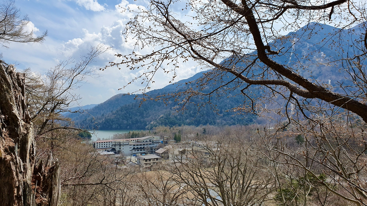
For the initial 10 minutes, it was all about rising through man-made stairs. It was mid-May in Japan. Although spring, it did not look like one. To me, winter left its marks everywhere. The trees deep in the mountains were grey without leaves. The mountains themselves looked empty. I imagined them buried in snow during winter a month back. In a few months, the trees would twist in brilliant autumn colours. I was cursing my luck; I wished I were here earlier or later. But in that instance, I would have missed this desolation.
Snow During the Hike
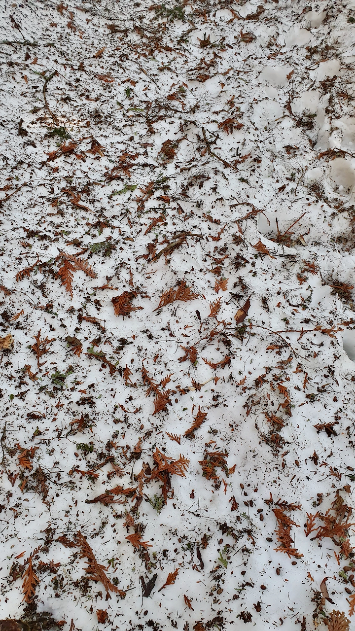
I was pondering all these and suddenly saw black patches of mud. Within the next 5 minutes, I stepped on ice. As I approached, the amount of whiteness beneath my feet increased. There was no one on the trail. My companion and I were all alone. The snow elated us, we are from a tropical country and had never experienced snowfall at home, where “bitter winter” means 10 degrees Celsius.
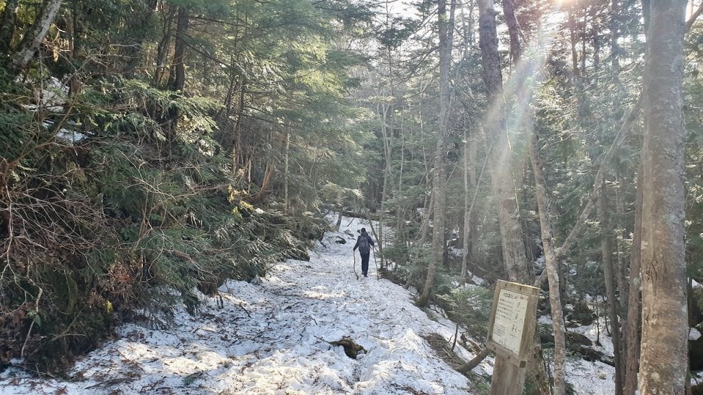
I tried to break some dead sticks to use them as a hiking pole. They were too fragile. I needed help and continued trying with fresh ones.
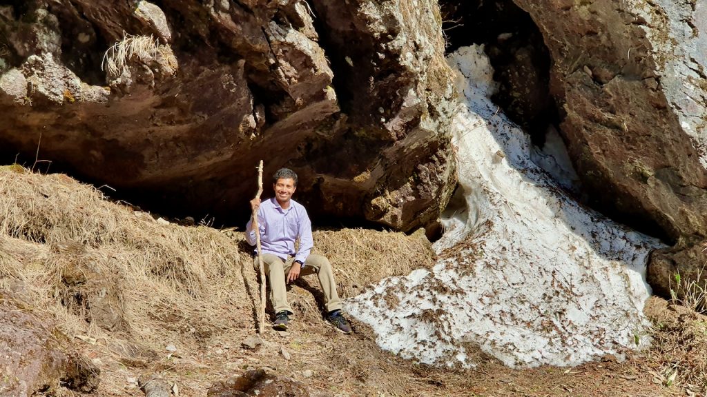
Our excitement about walking on ice receded. First, it became very slippery and made me fall down twice. As I was not expecting such a trail, my shoes did not have proper grip. Second, as the soft ice broke whenever we were striding forward, our feet went beneath it. We had to step with utmost care. Third, the pathway pointed in several confusing directions. Last, the sun started losing its glow by every minute.
Unsure how far the trail continued, we had to stop to review our plan. Should we go forward or back? Any sensible person would have chosen the first option. We had lost our minds that day, so, cursing each other and our luck, we marched forward.
To make the situation worse, I felt cold. The fancy fleece that had been sufficient an hour earlier was no longer warming me.
In the meantime, we crossed several wooden bridges and climbed stairs. The dead leaves on the ice created admirable natural patterns in some places.
The Final Leg
The forest became dense at some points and made it difficult to move. In films, a bear roams around in such kind of forest. It was not a film set, but the actual world. As much as I would want to see a bear coming out of the forest in a film, I was not at all interested in it happening in actual life. I panicked, a bit.
Are there bears in the forest? Any wolves?
I pulled out my phone to search on Google. But when did I ever get signal when I needed it most? My phone could not intercept any network coverage, and we were in the middle of nowhere.
💡 The bear answer (since my phone could not tell me): Yes, Asiatic black bears (tsukinowaguma) live in Nikko National Park, and Japan’s tourism ministry notes that Oku-Nikko is bear habitat where they are often sighted. Bears are most active in the early morning and evening and in rain, fog or cloud, so check recent sighting reports before you go. The Nikko Yumoto Visitor Center recommends a bear bell, preferably a high-pitched one, and making noise where visibility is poor. Keep food and rubbish secured. If you meet one, do not run, take photos or turn your back; back away slowly. Wolves have been extinct in Japan since the early 20th century, so at least that worry was unfounded.
Ignorance is bliss, so we pressed on.
When I started missing my scarf too, I spotted something on the horizon, a glimpse of emptiness. And I can vouch, I had rarely appreciated emptiness so much in my life.
We descended. The trail ended. We reached our destination.
We were right beside Karikomi Lake.
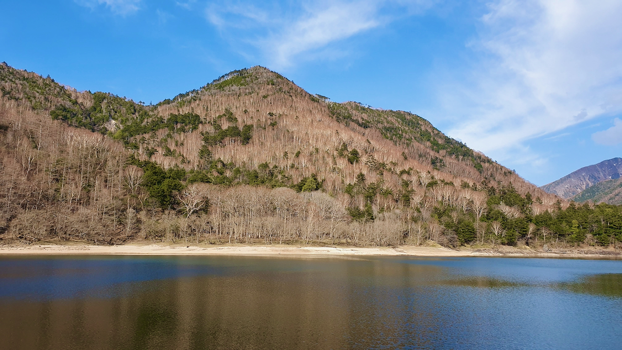
A majestic panorama of mountains surrounded us. An obvious reflection of Mount Taro on Lake Karikomi dazzled our minds. The water was so calm I could not see any waves. I wanted to jump in and indulge myself. But I did not want to disturb the meditating lake. Rather, I perched on a fallen tree, staring at the mountains, the lake, and its tranquillity.
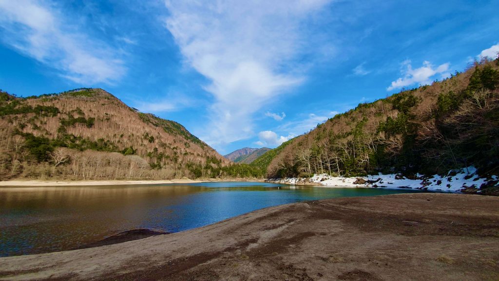
The time ceased. A pin drop of silence. Not a single human being to take away this silence. Just an hour of journey had taken me to a novel world. The actual world. A world expected to be just like this before the humans invaded.
Getting to the Trailhead and Practical Information
Getting to Yumoto Onsen (Trailhead)
From JR Nikko Station or Tobu-Nikko Station, take the Tobu Bus bound for Yumoto Onsen. The ride takes about 1 hour 20 minutes. The Nikko World Heritage Area Pass does not cover this route. The All Area Pass does, or you can pay per ride at the Tobu Bus counter. The fare is higher than the ¥1,250 to Lake Chuzenji because Yumoto is further along the same route, so check the current price when you buy.
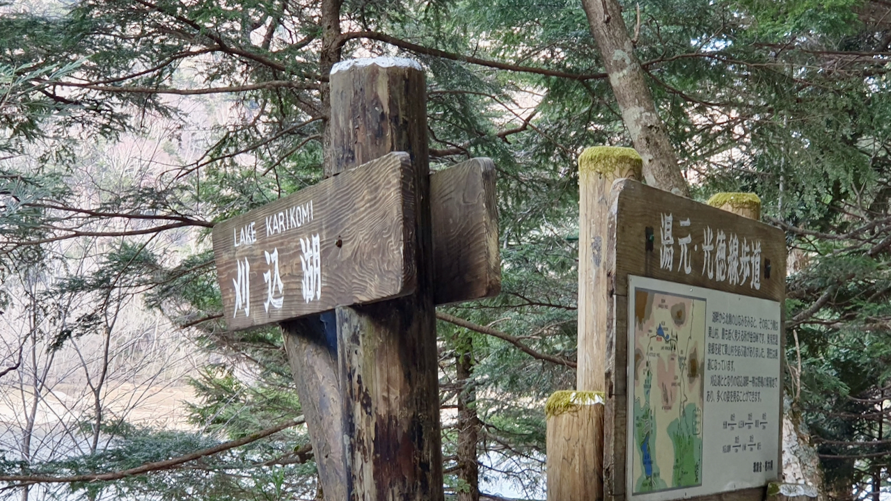
Get off at the last stop, Yumoto Onsen. The trail starts a short walk away. Do not expect a big signboard (I did not find one where my own hike began), so follow your offline map.
⚠️ Check the bus schedule. Buses to and from Yumoto Onsen are limited, and if you finish on the Kotoku side the return options are fewer still. Look up the timetable on Tobu’s Nikko bus page or at Tobu-Nikko Station and note the last bus before you start. The free Nikko Yumoto Visitor Center can tell you about bear sightings and trail conditions; it opens at 9:00 (8:30 in July and August), so it will not help with a dawn start.
💡 Nikko All Area Pass: The All Area Pass (¥8,000 for 4 days since April 2025) covers the Yumoto Onsen bus, but it only pays off if you take several other bus rides over 3 to 4 days. For a single hiking day, a pay-as-you-go return ticket will usually cost less. My Nikko guide compares the passes.
💡 Stay overnight in Yumoto Onsen: A night at Yumoto lets you start in the morning, which is the official advice, and saves you the long bus ride on the day. Kyukamura Nikko-Yumoto on Agoda is one option at Yumoto Onsen.
💡 Download your map offline. I had no phone signal for most of the hike. Download a Google Maps offline area or the AllTrails map before you leave Yumoto Onsen.
💡 Japan eSIM: If you rely on your phone for navigation across your Japan trip, get a Japan eSIM via Yesim via Yesim before your flight. It will not help deep in the forest, but it covers most of the rest of Japan.
Best Time to Visit
| Season | What to expect |
|---|---|
| Late April to May | Snow may remain around Golden Week. I met snow and ice in mid-May, and the trail was wet and slippery |
| June to early summer | Alpine flowers at Karenuma in early summer, according to the official Nikko guide |
| July to August | Wildflowers along the lakeshore, according to Japanese tourism pages |
| September to October | Autumn colour. Check a foliage forecast for Okunikko, as the timing varies by year |
| November to April | Expect cold and snow at this altitude. I would plan this hike for late spring to autumn |
💡 Best colour: autumn, when the official pages single out the foliage at Karenuma. Okunikko’s colours depend on the year, so check a current forecast before you book. Early summer is the other good window, for flowers.
What to Bring
- Hiking shoes with ankle support and grip (roots, mud and, in spring, ice)
- Extra grip for snow in spring (my shoes slipped on ice and I fell twice)
- Bear bell and a plan for noise on the trail
- Food and water: plan to carry everything you need
- A warm layer, plus a scarf or gloves if snow is possible (my fleece stopped being enough)
- Rain jacket (Okunikko weather can change quickly)
- An offline map downloaded before you start
Restrooms
The Nikko Yumoto Visitor Center lists restrooms at the Yumoto Onsen north car park and at the Kotoku car park and mentions none in between, so use them before you start and plan accordingly.
Extending the Hike to Lake Kirikomi
Lake Kirikomi is about 20 minutes beyond Lake Karikomi on foot. The two lakes connect except in periods of very little rain. If you have the energy, it is a small extra effort for a second lake, and from there the trail continues to Karenuma on the full route.
Karikomi Lake vs Other Nikko Hikes
How does Karikomi Lake compare to other hiking options in the Nikko area?
| Hike | Character | Difficulty | Best for |
|---|---|---|---|
| Karikomi Lake | Forest trail to twin lakes; about 70 minutes to the first lake, about 10 km for the full trail | Moderate | Quiet and a wilderness feel |
| Senjogahara | Open marshland with a boardwalk and mountain views | Easy | Scenery with little effort |
| Lake Chuzenji lakeside walk | A walk along the shore, close to Kegon Falls | Easy | Combining with sightseeing |
| Mount Nantai | Summit climb of the sacred mountain | Hard | Experienced hikers with an early start |
My verdict: Karikomi Lake suits visitors who want a real wilderness feel without extreme difficulty. Senjogahara is easier and gives broader views. Mount Nantai is for experienced hikers only. Karikomi sits in the middle, remote and rewarding without being punishing, provided you start early and respect the snow and the bears.
Should You Hike to Karikomi Lake?
Yes, if you accept two conditions: start in the morning and check the season. I did neither well, and it was still one of the most memorable hikes of my life in Japan.
The hike rewards effort with silence. I saw no one on the trail that May afternoon, and there was nothing at the lake but the water and the forest. What you get is about an hour of old forest where roots cross the path because the topsoil is shallow, and the main sound as you approach the lake is the crunch of your own footsteps.
When the lake appears, still and emerald, you will see what I meant when I wrote “a world expected to be just like this before the humans invaded.”
If you want crowds, waterfalls and cable cars, Kegon Falls and Lake Chuzenji suit you better. If you want something quiet and beautiful, walk to Karikomi Lake.
Frequently Asked Questions
How long does the Karikomi Lake hike take?
The Nikko tourism site gives about 70 minutes on foot from the Yumoto Onsen trailhead to Lake Karikomi, then about 20 minutes on to Lake Kirikomi. An out-and-back to the lakes is roughly 3 to 4 hours including a rest (my estimate from those times). The full trail to the Kotoku side is about 10 km and takes about 3.5 to 4.5 hours one way (the Nikko Yumoto Visitor Center says 4.5 hours or more).
Is the Karikomi Lake hike difficult?
It is rated moderately challenging. Tree roots cross the path, the stepped sections near each end are steep, and the footing can be slippery after rain or when snow remains in spring. I found snow and ice in mid-May harder than I expected, so grip and daylight matter more than fitness.
Is the Karikomi Lake trail open in winter?
The official pages I checked do not give a winter closure date, but Okunikko is a high mountain area and snow can linger into May. I would treat this as a late spring to autumn hike unless you have winter experience and current local advice. The Nikko Yumoto Visitor Center provides trail conditions and warnings about heavy snow and closed paths.
Are there bears on the Karikomi Lake trail?
Yes. Oku-Nikko is Asian black bear habitat and bears are often sighted there. They are most active in the early morning and evening and in rain, fog or cloud. Check recent sighting reports, carry a bear bell, make noise where visibility is poor, keep food secured and, if you meet a bear, do not run or take photos; back away slowly.
How do I get from Tokyo to Karikomi Lake?
Take the Tobu limited express from Asakusa to Tobu-Nikko (about 1 hour 50 minutes), or the Shinkansen to Utsunomiya (about 50 minutes) and the JR Nikko Line (about 40 minutes). Then take the Tobu Bus to Yumoto Onsen, about 1 hour 20 minutes. That is at least 3 hours each way, so a night in Nikko or Yumoto is more comfortable than a day trip.
Do I need the Nikko All Area Pass for Karikomi Lake?
The All Area Pass (¥8,000 for 4 days) covers the Yumoto Onsen bus, but the World Heritage Area Pass does not. For a single hiking day, paying per ride usually costs less, so only buy the pass if you plan several other bus rides over 3 to 4 days.
Should I do the out-and-back or the full trail?
For most visitors the out-and-back to the lakes is simpler, because you return to the same bus stop. The full trail adds Karenuma, a dry marsh known for early summer flowers and autumn colour, but it ends on the Kotoku side where buses back to Yumoto are limited. Start in the morning and check the last bus first.
Is there phone signal on the trail?
I had no signal for most of my hike, so download an offline map before you leave Yumoto Onsen. Do not rely on your phone to find the way or to look up information in an emergency.
Can I hike to Karikomi Lake with a guide?
Yes. The Nikko tourism site lists licensed local guides for this hike. I walked it without one, so I cannot compare guides, but a guide makes sense if you are visiting in snow season or are unsure about the route.
More Hikes and Nature Near Nikko
If the Karikomi Lake trail appeals to you, these are other outdoor options to consider:
- Senjogahara Plateau (Nikko): open marshland with a boardwalk and mountain views, a contrast to the dense forest of Karikomi
- Lake Chuzenji lakeside walk (Nikko): an easy walk close to Kegon Falls
- Hokkaido: if you are visiting Sapporo, my day trips from Sapporo guide covers outdoor options there
Yumoto Onsen is a hot spring town, so a soak is the obvious way to finish the day. Ask at your hotel or the onsen facilities about day-use bathing and prices, as I have not checked the current rules.
If this hike is part of a wider Nikko trip, read the full Nikko guide guide, and see how Nikko fits into the wider Japan trip in my 2-week Japan itinerary and 4-Day Tokyo Itinerary.
Loved this hike? Pin it for later!

Leave a reply