Mizen Head is the most south-westerly point of mainland Ireland and one of the most dramatic places to visit on the entire Wild Atlantic Way. The big draws are the 1910 arch bridge spanning a churning Atlantic gorge, the cliff walk above 100-metre drops, and the old signal station, now a museum, perched at the very edge of the country. This guide covers the bridge, the gorge, the cliffs and the signal station, plus all the practical details you need before you go.
Where Ireland Runs Out
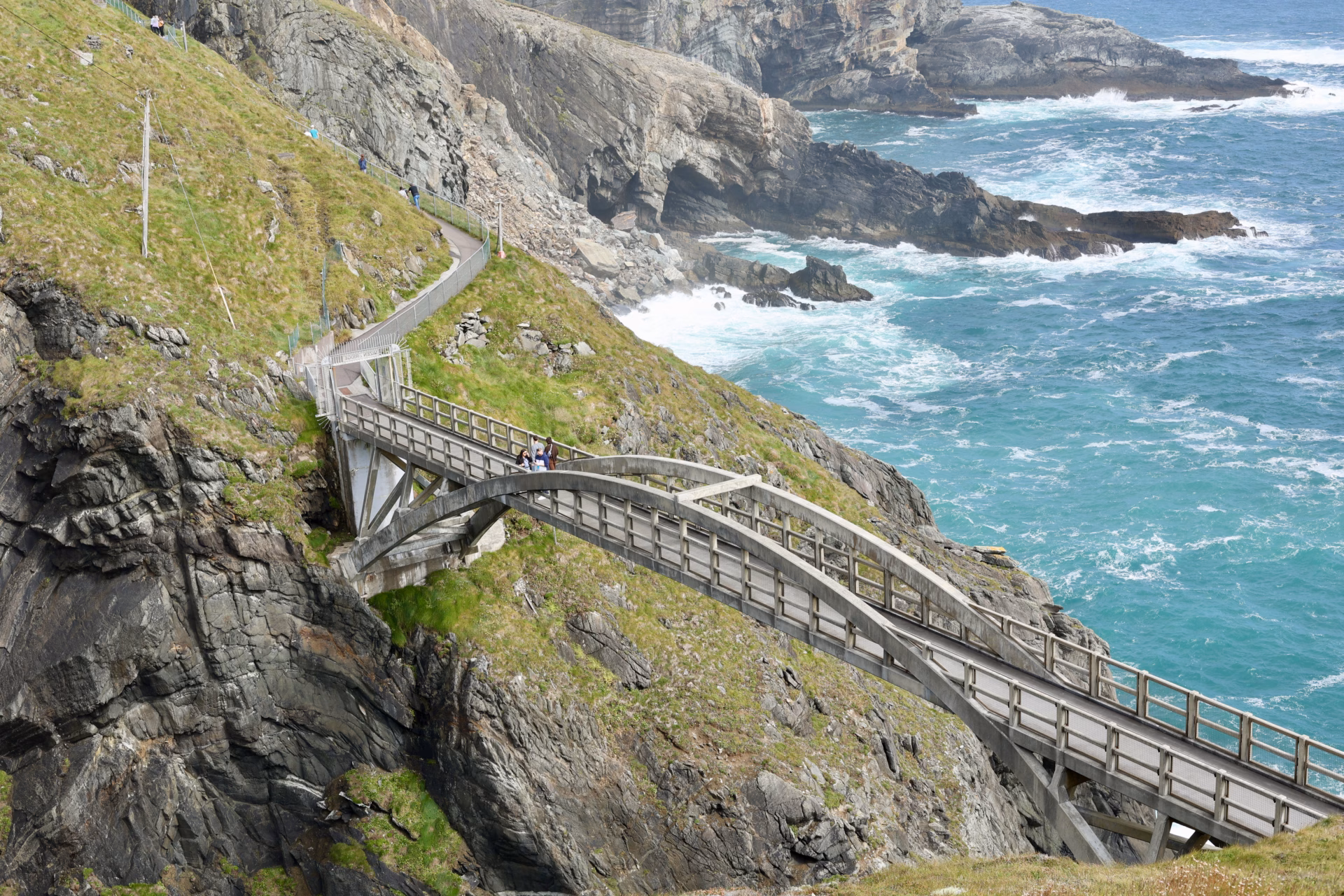
The Atlantic doesn’t arrive quietly at Mizen Head.
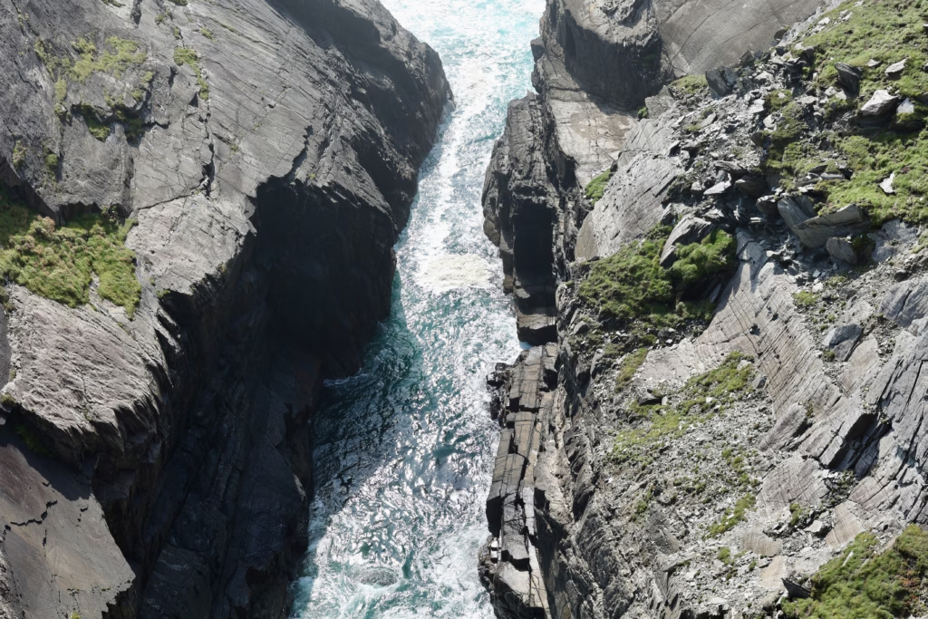
It rolls in off three thousand miles of open water and throws itself straight into the base of a gorge between two rock faces, with a force you feel in your chest before you’ve worked out where the sound is coming from. The cliffs here climb more than 100 metres above the sea. On a rough day the spray reaches the path. And strung across that gorge, 150 feet above the churn, is a bridge.
Standing on it and looking down is one of those small, delicious jolts of fear that travel hands you every so often. Your head knows the bridge is perfectly safe. The rest of you is less convinced.
This is Mizen Head, the far south-western tip of Ireland, and it earns every bit of its reputation.
What Is Mizen Head?
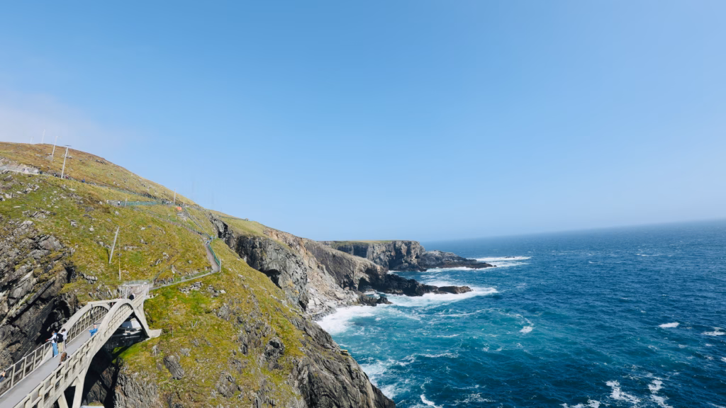
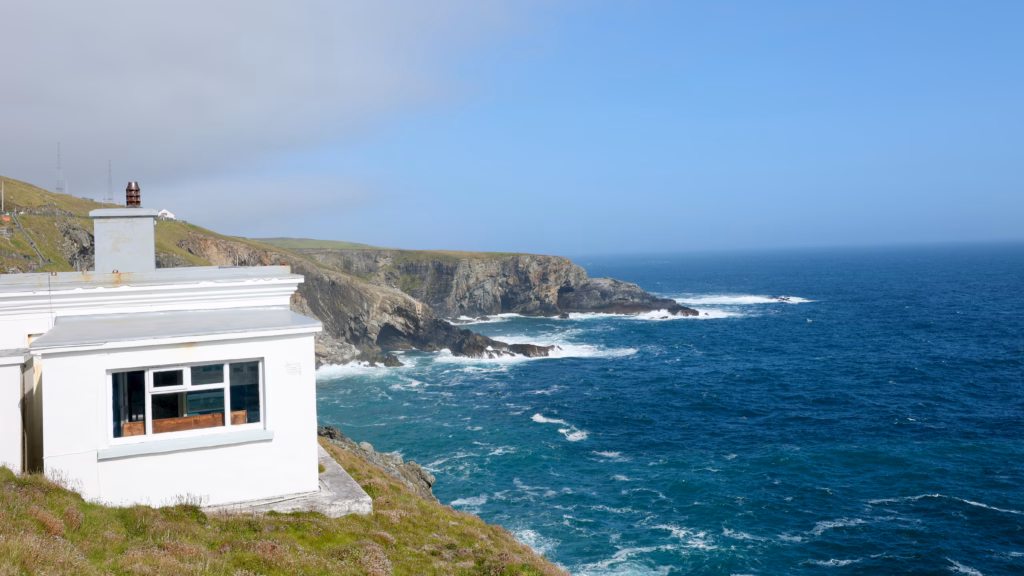
Mizen Head is the most south-westerly point of mainland Ireland, right at the end of the Mizen Peninsula in West Cork. Two things make it famous: the Mizen Head Signal Station, a fog signal and navigation station set up in the early 20th century, and the Mizen Head Bridge, a reinforced concrete arch built in 1910 to connect the mainland to the signal station’s rocky island.
These days it’s run as a visitor attraction, with a visitor centre, a museum inside the old signal station, and a full cliff walk out to the viewing platforms on the far side of the bridge.
One common mix-up worth clearing up: Mizen Head is not the southernmost point of Ireland. That’s Brow Head, about 15 minutes away, which beats it by a sliver of latitude. But Mizen Head is the more dramatic of the two by some distance, and the only one set up to receive visitors properly.
The Bridge
Everything here leads to the bridge, and the bridge lives up to it.
It’s a reinforced concrete arch, built in 1910 when that counted as a serious feat of engineering, spanning 150 feet across the gorge between the mainland cliffs and the signal station rock. Below it, the Atlantic does what it always does at Mizen Head: crashes in, boils white, drags back, and crashes in again.
Crossing it takes the particular nerve of someone whose brain trusts the structure completely while the rest of them takes note of the drop, the wind and the noise and decides to mention all three. You grip the railing. You look down. You look quickly back up. You cross.
Here’s what crossing actually looks like from above, the bridge, the gorge, the Atlantic working below, all in one shot:
Stills don’t quite get across the scale; the video does.
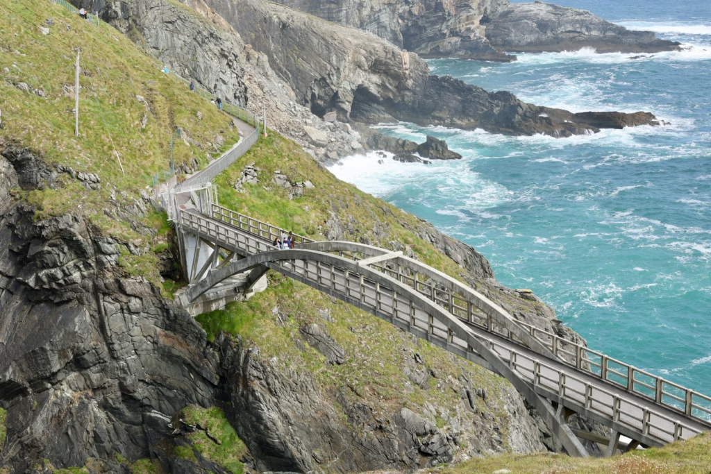
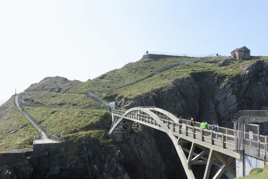
Between the visitor centre and the signal station there are 99 steps in total, a number so often repeated locally that it’s practically part of the brand. They’re steep in places. They are also entirely worth it, and you’ll forget the count the moment the bridge comes into view.
From below, the engineering really announces itself. Look up at the arch from the lower path and the span feels far bigger than it does when you’re walking over it.
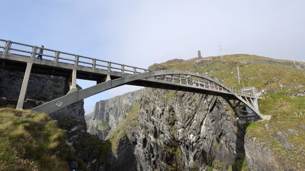
For a sense of where everything sits, the classic angle from the gate takes in the bridge, the crossing, and the station buildings on the far hill all at once.
What no photo quite gets across is the feeling of being out on it, mid-span, with ocean on both sides and the path curling away along the clifftop behind you.
The Gorge
The gorge under the bridge is the dramatic heart of the whole place, and the photographs you take looking down into it will be the ones you keep coming back to.
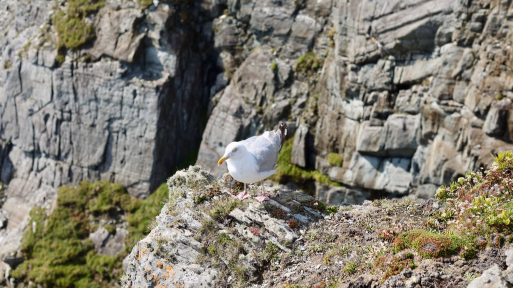
Lean over the railing and the rock faces drop away vertically, banded in the grey striated slate that makes up the entire peninsula. The sea forces itself through the narrow gap in a constant churn of white. Seabirds ride the updrafts. The noise never lets up.
Watch the birds for a while and the scale of the cliffs suddenly makes sense. A herring gull with a wingspan of well over a metre looks tiny against the rock when it drops into the gorge.
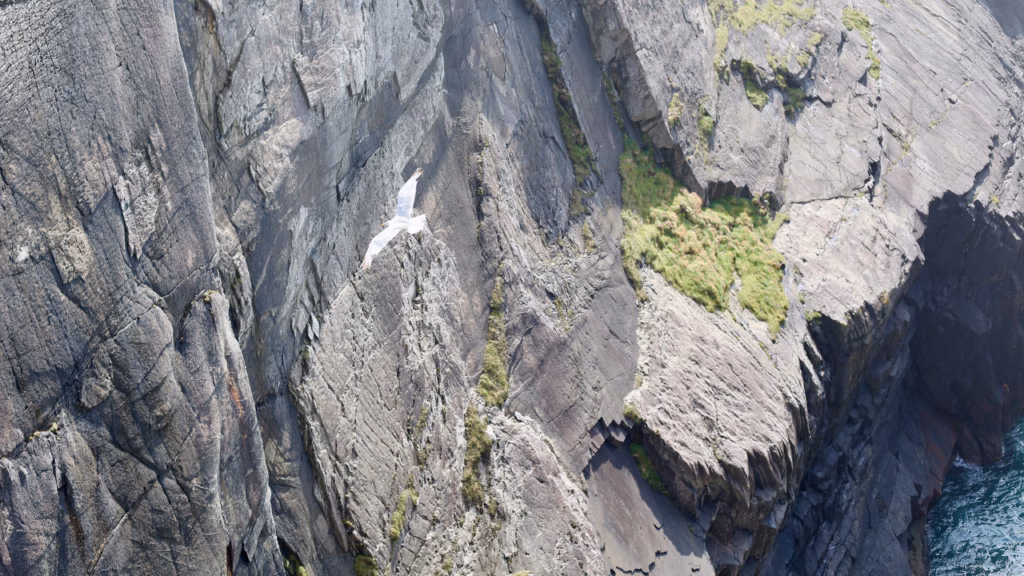
They nest here all year, and they have a composure on the exposed rock that visitors edging toward the railing rarely manage.
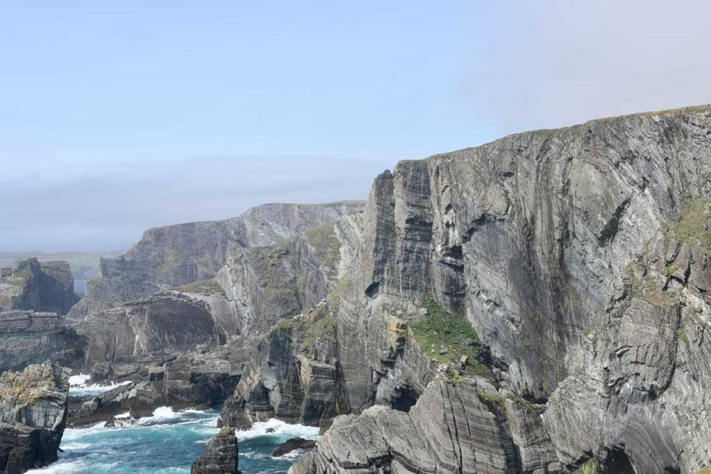
The Cliffs
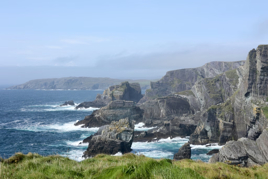
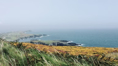
Cross to the signal station side and the cliff walk shows you the full scale of Mizen Head.
From the platforms out there, the coastline runs off in both directions, the Atlantic turns turquoise below, and on a clear day you can pick out the Beara Peninsula to the north and Fastnet Rock to the south. The geology is the quiet star of it. The slate was laid down around 300 million years ago and then folded and compressed, and you can read that whole violent history in the layered patterns running through the rock.
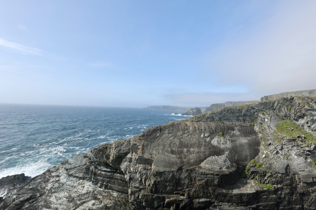
One detail most people walk straight past is the natural arch worn into the eastern cliff face.
Looking east from the same spot, the colour is what holds you, that hard turquoise against wet grey rock that turns up all over Mizen Head.
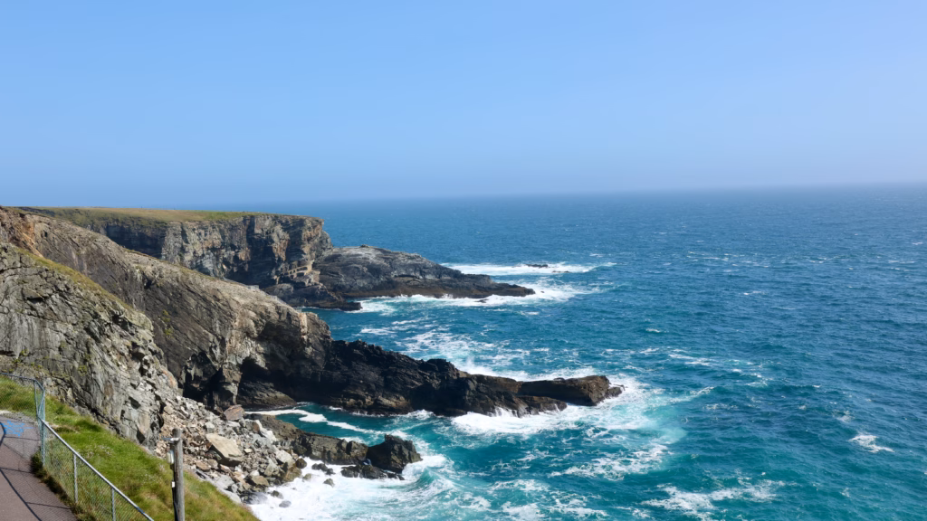
Below the platforms, sea stacks stand off from the fractured cliff edge where the rock has finally given way to the weather.
If you’re at all interested in how landscapes are made, the folded strata here are worth a long look. Few stretches of the Wild Atlantic Way show the process this plainly.
Inside the Signal Station
The signal station went up in the early 20th century as a fog signal and navigation aid for ships threading the busy lanes off Ireland’s south-west coast. For decades it was staffed all year round by lighthouse keepers who lived and worked out here, at the far end of a 150-foot bridge above the Atlantic.
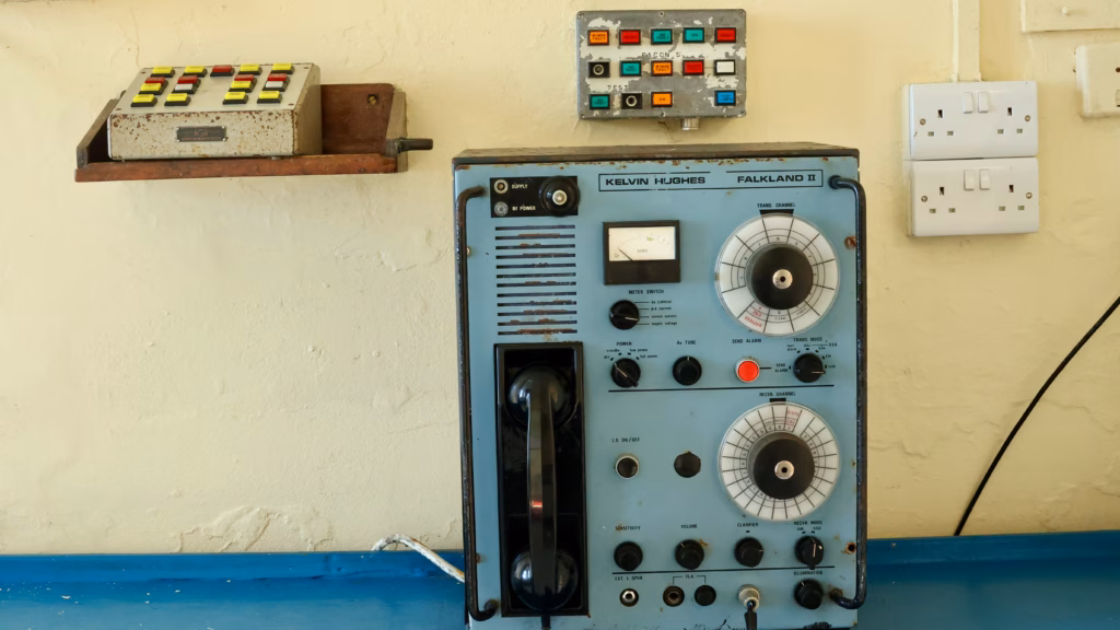
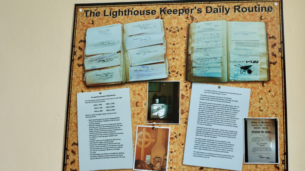
The visitor centre tells their story through the keepers’ daily routines, the station’s communications gear and the wider maritime history of the headland, and it does it well. The building itself is the first exhibit, white-painted concrete built squat and solid to take whatever the weather throws at it.
What makes the museum worth your time is how specific it is. This isn’t generic heritage-centre filler; it’s the actual kit, in the actual rooms. The Kelvin Hughes radio set still sits where it was operated.
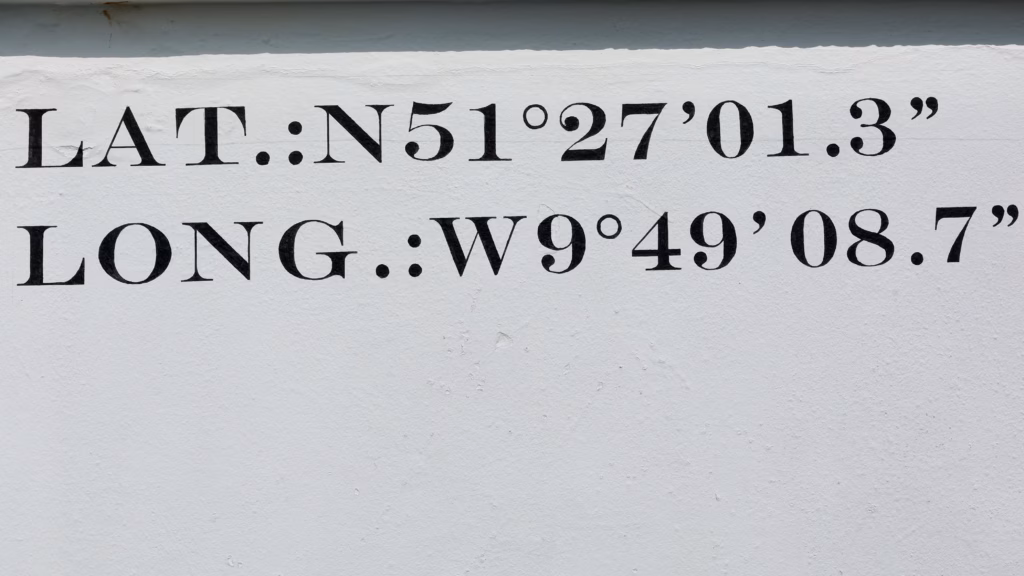
Outside on the wall, someone has painted the station’s exact position, which is a lovely thing to stand next to when you remember you’re at the most south-westerly point of the country.
Back inside, the recreated living quarters do something the equipment can’t. A wax keeper sits at his table over tea and toast, and it tips the whole place from “museum” into something closer to a memory.
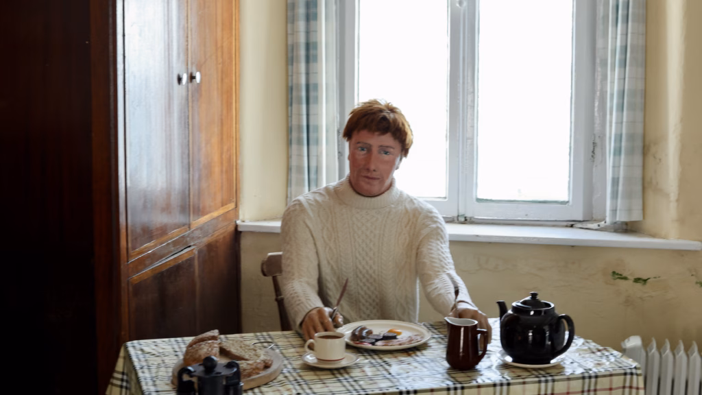
The routine board beside it spells out just how relentless that life was: four-hour watches around the clock, weather logged every hour, navigation aids and distress channels checked constantly.
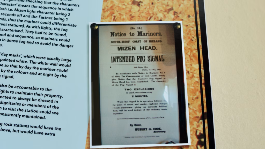
There’s a particular favourite of mine in the exhibits too: a Notice to Mariners describing the old fog signal, which was nothing as gentle as a horn.
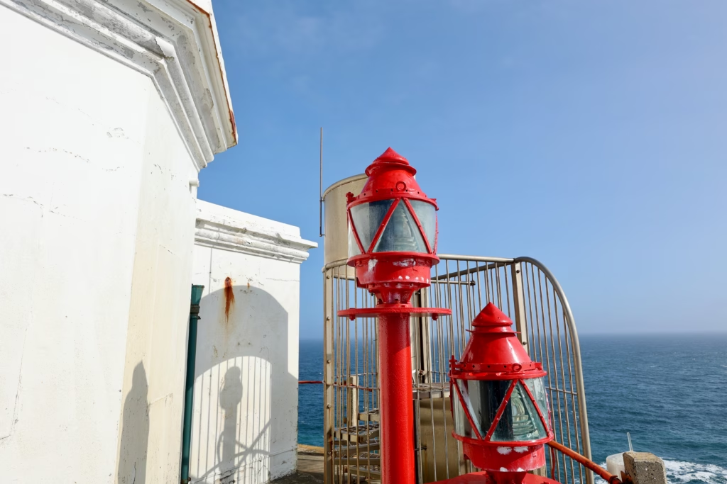
Step back outside and the most photogenic detail of the whole visit is waiting by the station: the navigation lanterns, scarlet against the sky.
What the Visitor Centre Is Actually Like
The visitor centre is well run and genuinely interesting, not the box-ticking exercise these places can sometimes be. A 2024 refurbishment enlarged the café, refreshed the exhibits and tidied up a building that takes a real battering from the weather.
The strength of it, again, is the specificity: the real radio set, the real logbooks, the real shape of a life spent at the end of a bridge above a gorge in one of the most exposed spots in Europe. The wax keeper at his table manages to be a little eerie and quietly affecting at the same time.
Give yourself at least 30 minutes inside the station before the cliff walk, partly for the exhibits and partly because those 99 steps back up are kinder when you’re not in a hurry.
Mizen Head: Practical Information
A few essentials before you go. Entry is €7.50 for adults, €6 for seniors and students, €4.50 for children under 14, free for under-5s, and €25 for a family of two adults and up to four children, payable by cash or card. The centre opens daily from April to October, 10am to 5pm with last admission at 4:30pm, and weekends only through winter. To get there, follow the signs from Goleen village on the R592; the car park is large and free.
Allow a minimum of 1.5 hours for the full experience, taking in the bridge, the museum and the cliff walk, though two hours is more comfortable. A word on access: the route to the bridge involves those 99 steps and some steep sections, so it isn’t suitable for wheelchairs or anyone with significant mobility difficulties, though the visitor centre itself is accessible. Bring layers, since the wind on the bridge can be fierce, and keep a hand on your hat. The café, expanded in the 2024 works, is a welcome spot to thaw out after the cliff walk.
Prefer not to drive? The West Cork to Mizen Head Full Day Tour from Cork is the most direct guided option, a full day taking in the peninsula’s highlights with a local guide, leaving from Cork city.
The Rest of the Mizen Peninsula
Mizen Head is the headline, but don’t drive all this way and stop there. Within easy reach:
- 👉 Brow Head, the actual southernmost point of Ireland, 15 minutes away
- 👉 Galley Cove Beach, the hidden cove with the Marconi story, near Crookhaven
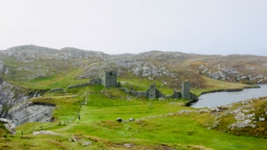
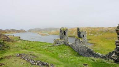
- 👉 Three Castle Head, the medieval castle above a clifftop lake, 20 minutes away
- 👉 Seskin, the Bantry Bay viewpoint on the drive in
- 👉 The full Mizen Peninsula day trip guide from Cork
Planning more of Ireland from Cork? The Ring of Kerry Guided Day Trip from Cork is the obvious next move, with a coastline that’s different in character from West Cork but every bit as good. For somewhere quieter, the Full-Day Tour to Dingle Peninsula from Cork heads into Irish-speaking country and some of the finest scenery in the country.
Have you crossed the bridge at Mizen Head? Tell me how your nerve held in the comments.
If this was useful, save it to Pinterest for your West Cork planning and pass it on to anyone heading for the south-west.
Leave a reply