Three Castle Head is one of the most extraordinary places in West Cork, and one of the least visited. At the far western tip of the Mizen Peninsula, beyond Crookhaven and beyond the reach of the tour buses, a rough walk over open moorland leads to Dunlough Castle: a 13th-century ruin perched above a dark clifftop lake, with the Atlantic crashing somewhere below. This guide covers how to get there, what the walk is honestly like, and why it’s worth every uncertain step.
The Castle Nobody Tells You About
There’s a moment on the walk out to Three Castle Head when the ruins finally appear on the skyline, and the whole strange journey to get there suddenly clicks into place. The narrow roads, the mist that won’t lift, the thick grass you’ve been picking your way across without ever being quite sure where your foot will land. All of it, right then, feels worth it.
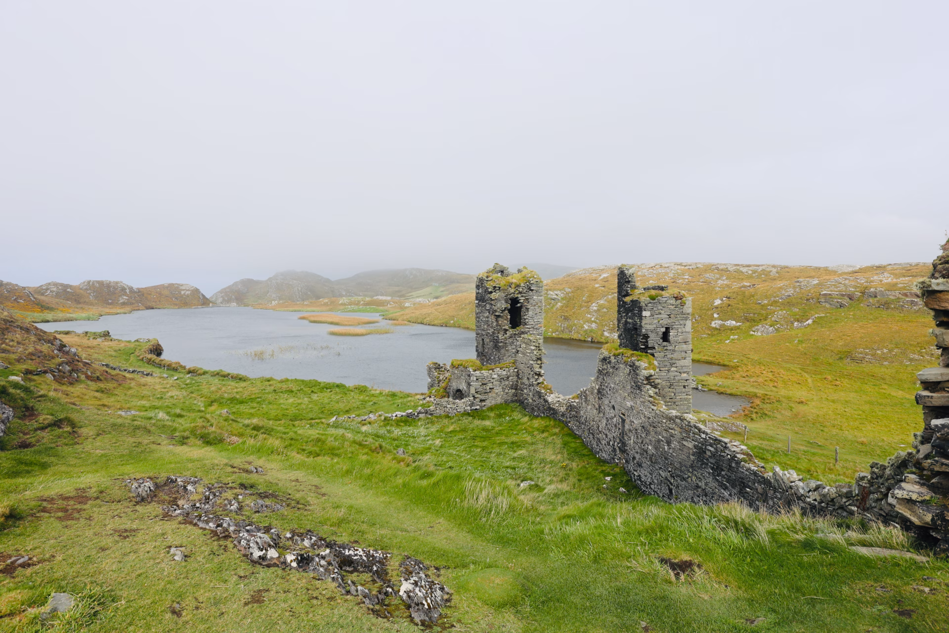
Two towers. A length of curtain wall slung between them. A lake sitting dark and still in front, and somewhere past the cliffs, hidden in the fog, the Atlantic.
I stopped and just looked for a while.
Three Castle Head sits right at the western tip of the Mizen Peninsula, out beyond Crookhaven and beyond almost everywhere the usual tourist machinery has bothered to reach. The road runs out. The tarmac runs out. What’s left is a walk across working farmland and open moorland, along clifftops above a sea that has no interest in your plans, and at the end of it, Dunlough Castle. Built in 1207. Reachable only on foot. Visited by almost nobody who isn’t already there on purpose.
So here’s the practical, honest, been-there guide to visiting it, because not many of those exist.
What Is Three Castle Head?
Three Castle Head is a headland at the far western point of the Mizen Peninsula, near the village of Crookhaven in West Cork. The name comes from Dunlough Castle, a fortified tower house the O’Mahony clan built here in 1207. It originally had three connected towers, which is where the “three castle” name comes from, though only two of them still stand in any real sense today.
What makes the setting so unusual is the geography. The castle sits on a promontory directly above Lough Fadda, a dark lake pinned between the castle walls and the sheer Atlantic cliffs. Still water and old stone on one side, open ocean on the other. You don’t see many ruins positioned quite like it.
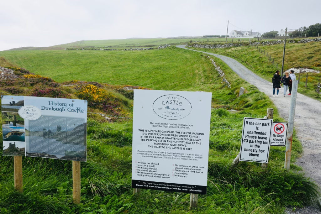
The whole site is privately owned and run as a working farm and conservation area. The walk to the castle is free. Parking is €3 per person, paid into an honesty box.
Getting There
Three Castle Head is near Crookhaven, at the western tip of the Mizen Peninsula. From Cork city it’s roughly a 2.5-hour drive. If you’re already at Mizen Head and combining the two in one day, it’s about 20 minutes back along the peninsula road.
From Crookhaven village, follow the road toward Barleycove and watch for the Three Castle Head sign on the left. It’s easy to sail straight past. The lane down to the car park is narrow, and the car park itself is really just a field beside the farmhouse with room for maybe 15 to 20 cars.
If you’re using GPS, searching “Three Castle Head, Crookhaven” will get you close enough. The final lane doesn’t have a name. Parking is €3 per person in the honesty box at the pedestrian gate, children under 12 go free, and the walk beyond it costs nothing.
If you’re hiring a car for this, it’s worth comparing rates before you land. Discover Cars pulls together prices from the different suppliers at Cork Airport, and the smaller cars tend to go first in summer, so booking ahead pays off. A compact is also far less stressful on these lanes than anything wide.
The Walk: What It’s Actually Like
I’ll be straight with you about the walk, because a lot of guides aren’t.
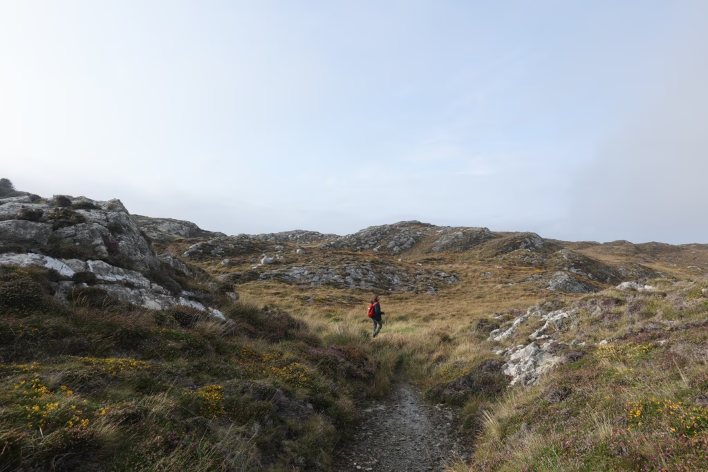
This is not a maintained trail. No gravel path, no waymarkers, no handrail. What you get is a track across farmland that turns into a rough path over open moorland, through gorse that comes up to your ankles and knees, over ground that’s uneven in ways you can’t always see coming.
The grass is thick and tussocked, and it hides what’s underneath it. With most steps I genuinely wasn’t sure whether my foot would find solid ground or slide off into a hollow. None of this is dangerous if you’re paying attention and wearing the right shoes, but it’s not a gentle stroll either. It asks for your full concentration.
And honestly, that’s part of why the place gets under your skin. You can’t drift along looking at your phone. You watch the ground, feel each step, stay present the whole way out. By the time the castle appears, you’ve properly arrived.
A few quick numbers before you set off. It’s about 3km there and back from the car park, and you’ll want to allow 1.5 to 2 hours including time at the castle. The terrain is farmland giving way to gorse, rock and moorland, uneven throughout, with some steep bits near the cliff edge. Walking boots or trail shoes only; trainers will let you down on wet, hidden ground. Bring a waterproof, because the mist arrives without warning, and carry your own water and snacks, as there’s nothing at all out there. And note the rules: no dogs even on a lead, no drones, no commercial photography without consent, no climbing on the castle, no camping.
The Approach: Arriving at the Edge of Something
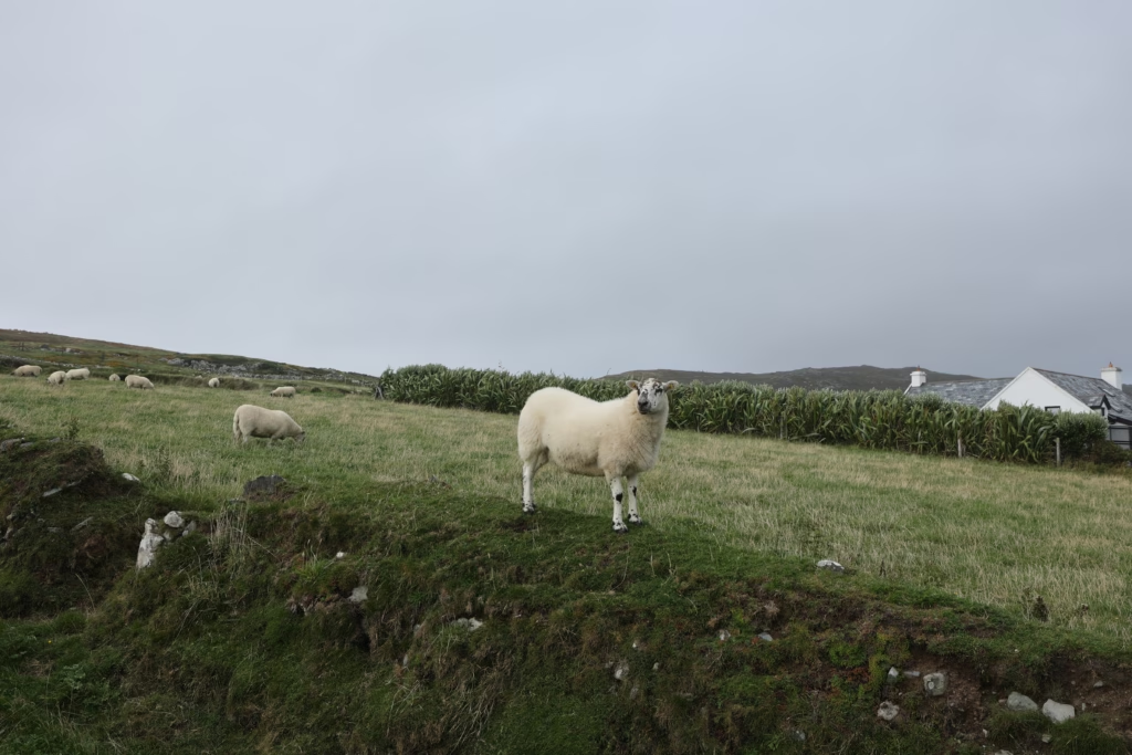
The walk starts gently enough, through green farm fields with sheep grazing and white farmhouses dotted up the hillside. It’s that very West Cork mix of working farm and wild edge, side by side. The sheep have seen plenty of visitors and are entirely unbothered by another one.
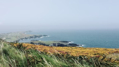
Then the farmland loosens into open moorland and the whole mood shifts. Yellow gorse and purple heather spread out toward the horizon, and the low mist over the hills lends everything a muted, faintly otherworldly feel. Ireland in August can be all bright greens and blue water. It can also be this: grey-green, elemental, old. Both are true, sometimes on the same afternoon.
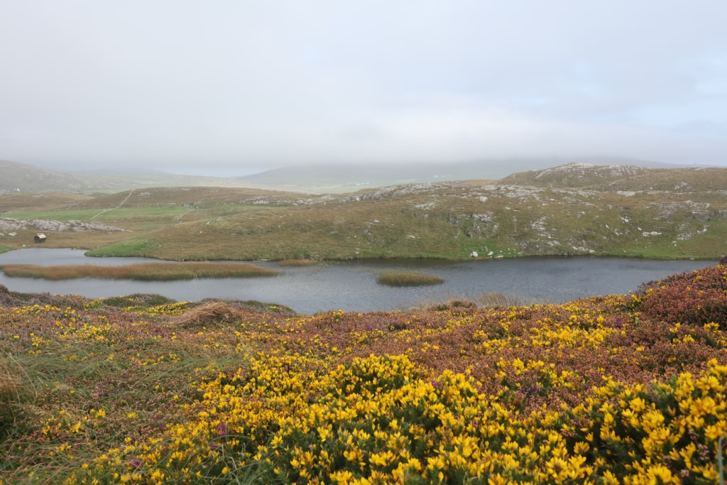
You walk on, and the lake comes into view. Then, beyond the lake, the towers.
The Castle: 800 Years of Standing Still
The O’Mahony clan built Dunlough Castle in 1207. They were one of the powerful Gaelic Irish families who held this corner of West Cork through the medieval centuries, and they chose the site shrewdly. It’s a promontory fort, designed to make the most of the headland’s natural defences: the lake on one side, Atlantic cliffs on another, and open moorland in front giving a clear line of sight to anyone approaching.
In its day it would have been a hard place to take. Three towers linked by a curtain wall, holding a near-impregnable position at what must have felt like the edge of the known world. Ships were visible for miles from the upper windows. The lake gave fresh water. The cliffs ruled out any attack from the sea.
Now, two towers still stand with any real height to them. The third has mostly slumped into rubble, the curtain walls survive in stretches, moss has crept over everything, and the window openings frame nothing but sky and water.
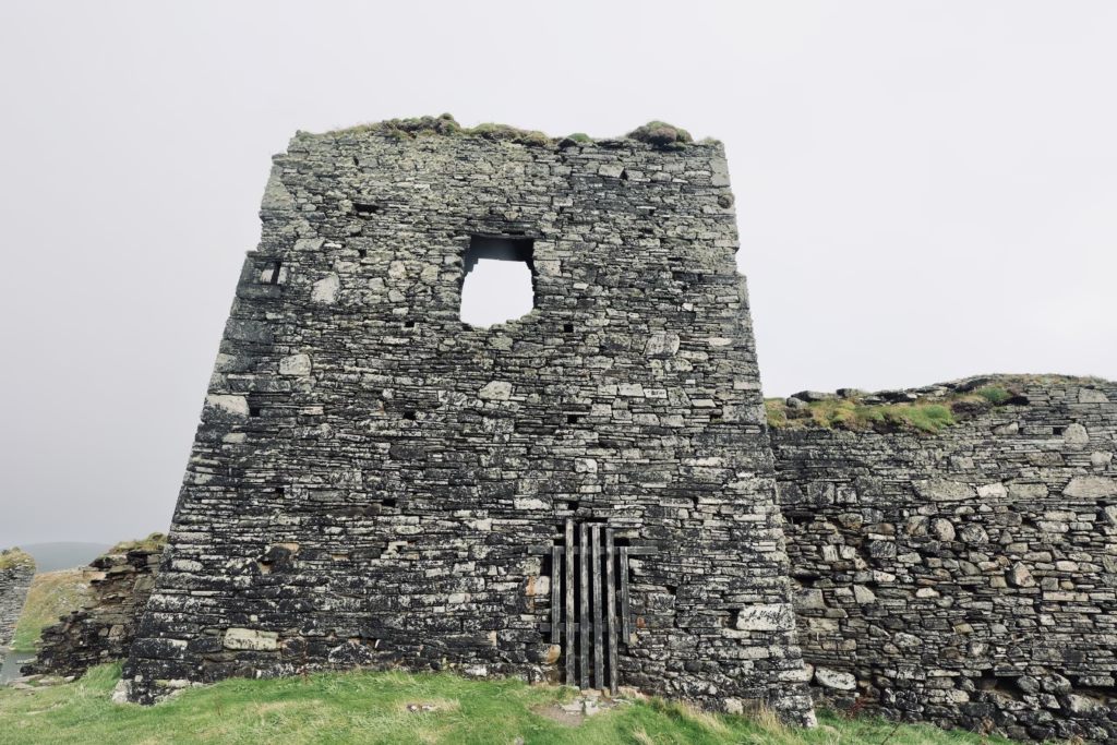
What gets you, standing in front of it, isn’t really the drama of the location, though that lands too. It’s the sheer stubbornness of the thing. Eight hundred years of wind and rain and salt, and the stones are still here, still stacked, still unmistakably a castle. You find yourself a little awed by how much weather it has simply outlasted.
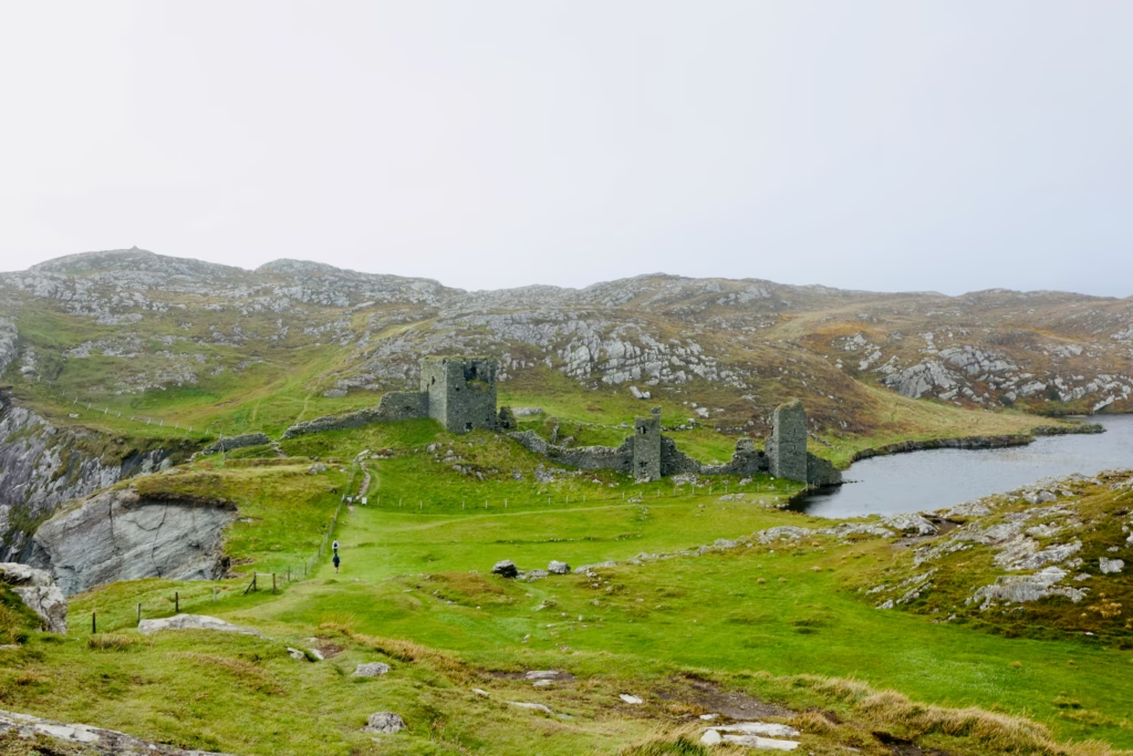
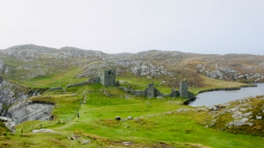
Walk on a bit and the setting opens up properly, the towers reading against the lake and the hills behind.

From higher ground you finally get the full scale of it, and the isolation reads all at once when there’s a person in the frame for size.
The Lake and the Cliffs
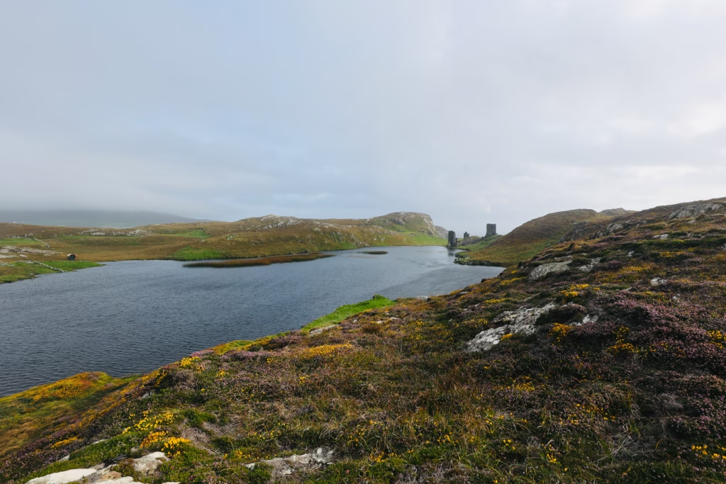
Lough Fadda sits in a hollow between the castle and the Atlantic cliffs, so neatly placed it looks designed, though it’s entirely natural. Dark water, reeds along the edges, the towers mirrored in it on still days. The afternoon I was there, with the mist down and the light flat and grey, it had the colour of old pewter.
Past the lake and the castle, the land drops away to the sea, and this is where the walk pays you back in full. The clifftop on the far side of the castle looks out over a sea gorge cut between vertical rock faces, a sea stack standing up out of the water below, and the far headlands dissolving into haze.
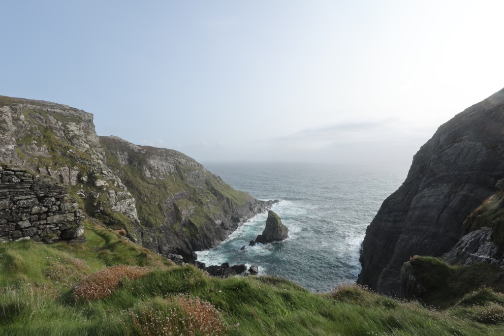
There’s none of the managed safety of Mizen Head here, no paths or railings or visitor centre. No fences either. The cliff edge is simply where it is, and you keep whatever distance from it feels right. That refusal to be tidied up and signposted is, like the walk and the castle and most of West Cork, the whole point.
Why Three Castle Head Stays With You
A lot of Ireland’s big-name sights are famous for delivering. The Cliffs of Moher, the Ring of Kerry, Mizen Head itself: reliable, photogenic, share-ready, and efficient about it, with a car park and a café and a clear route to the best view.
Three Castle Head doesn’t work like that. It gives up its beauty grudgingly, after a rough walk over uncertain ground in weather that may or may not play along. You earn the view, and because you earn it, it means more when it comes.
The castle would be remarkable anywhere. Out here, at the end of the road and the edge of the peninsula, above a dark lake above the Atlantic, it’s something else again. Easily my favourite stop on the whole peninsula.
Three Castle Head: Practical Summary
| Details | |
|---|---|
| Location | Near Crookhaven, Mizen Peninsula, West Cork |
| Distance from Cork | ~2.5 hours by car |
| Walk distance | ~3km return |
| Walk time | 1.5–2 hours |
| Entry fee | Free (€3 parking honesty box) |
| Difficulty | Moderate; uneven terrain, no maintained trail |
| Footwear | Walking boots essential |
| Dogs | Not allowed (even on a lead) |
| Drones | Not allowed |
| Best time | May–October. Go early, the car park is tiny |
| Facilities | None. Bring water and snacks. |
| Website | threecastlehead.com |
Making a Day of It on the Mizen Peninsula
Three Castle Head slots neatly into a full day exploring the Mizen Peninsula from Cork. A run that works well:
- Seskin, for the Bantry Bay viewpoint on the way down
- Galley Cove Beach
- Three Castle Head, allow 2 hours
- Mizen Head Signal Station, allow 1.5 to 2 hours
- Back via Schull
👉 Read the full Mizen Peninsula day trip guide
Nearby
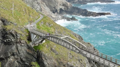
Mizen Head Signal Station is 20 minutes away: the famous arch bridge, the gorge, the signal station museum, and the busiest site on the peninsula.
Galley Cove Beach is about 30 minutes off, a sheltered sandy beach near Crookhaven with clear water and a surprising wireless-telegraph history.
Brow Head is roughly 25 minutes away, the true southernmost point of mainland Ireland, with a short clifftop hike above Crookhaven and a Napoleonic signal tower.
Not driving? The West Cork to Mizen Head Full Day Tour from Cork is the easiest guided way to reach the peninsula. You’ll still walk out to the castle yourself, but the tour takes care of all the driving in between.
Been out to Three Castle Head yourself? Tell me how you found the walk in the comments.
If this helped, pin it or share it, and have a look at the full Mizen Peninsula guide for the rest of West Cork.
Leave a reply